Fort Stanton Cave Study Project: Surface Weather
Fort Stanton Cave Study Project: Surface Weather |
Note: You can search for a name or topic by using a control-f (for PCs) or a command-f (for Macs)
Station |
Location Details |
Latitude |
Longitude |
Elevation (ft.) |
Distance from FSC Ent (mi) |
Hardware |
Software/ Comments2013 |
MADIS ID |
Comments &July 2011 Monthly |
N 33 ° 30 ' 33 '' |
W 105 ° 30 ' 3 '' |
6107 |
0.44 @ 291.2T |
Data back to Sep 2009 |
Monthly History | ||||
| Airport, Ruidoso, NM | ~ 33.46083 N |
~ -105.53044 W |
~ 6772 |
3.82 @ 213.7T |
Good data back to 2005. | Weekly History, Monthly History, 2013 | |||
Ruidoso, NM |
N 33° 19' 12" |
W 105° 38' 12" |
6530? |
Davis Vantage Pro 2/Vue | Weatherlink-IP | ||||
Alto, NM |
N 33 ° 25 ' 29 '' |
W 105 ° 34 ' 35 '' |
6693 |
7.41 @ 219.9T |
WeatherDisplay:10.37 | Monthly History | |||
Lizard Roost, Alto, NM |
N 33 ° 25 ' 39 '' |
W 105 ° 38 ' 43 '' |
7200 |
10.34 @ 237.9T |
Davis Vantage Pro2 | Meteobridge; Updated hardware |
2013 History | ||
| Eagle Creek Hill, Ruidoso, NM | N 33 ° 23 ' 35 '' |
W 105 ° 38 ' 44 '' |
7200 |
11.78 @ 228.1T |
Davis Vantage Pro | Wunderground v.1.15, Data to Sep 2007 | AS769 |
||
| Eagle Creek Canyon, Ruidoso, NM | N 33 ° 23 ' 26 '' |
W 105 ° 38 ' 05 '' |
7000 |
AcuRite Pro Weather Center | |||||
| 1 White Mountain Meadows, Ruidoso, NM | N 33 ° 22 ' 31 '' |
W 105 ° 39 ' 2 '' |
7120 |
12.80 @ 224.9T |
Davis Vantage Pro | VWS V13.00. Good data back to 2005. |
Monthly History | ||
Alto Lakes Country Club, Alto, NM |
N 33 ° 24 ' 1 '' |
W 105 ° 40 ' 30 '' |
7300 |
12.8 @ 234.9T |
LaCrosse Weather Pro 2317 | offline? |
|||
| Ranches of Sonterra, Alto, NM | N 33 ° 21 ' 33 '' |
W 105 ° 38 ' 24 '' |
6511 |
13.23 @ 219.7T |
La Crosse | VWS V13.01, offline? |
|||
| SMOKEY BEAR NM US, Ruidoso, NM | N 33 ° 20 ' 59 '' |
W 105 ° 40 ' 1 '' |
6897 |
14.75 @ 222.7T |
Monthly History | ||||
| Nogal and Carrizozo, Carrizozo, NM | N 33 ° 36 ' 27 '' |
W 105 ° 46 ' 18 '' |
6066 |
17.39 @ 293.3T |
Davis Vantage Pro | Wunderground v.1.13 | C3827 |
Monthly History | |
| SIERRA BLANCA NM US SNOTEL, Alto, NM | N 33 ° 24 ' 0 '' |
W 105 ° 47 ' 24 '' |
10276 |
18.60 @ 246.6T |
Monthly History | ||||
MESCAL NM US, Bent, NM |
N 33 ° 9 ' 29 '' |
W 105 ° 46 ' 8 '' |
6225 |
28.8 @ 213.6T |
Monthly History | ||||
| Same as KNMRUIDO3? | N 33° 23' 37" | W 105° 38' 44" | 7152 |
Davis Vantage Pro2 | Weatherlink | AS769 |
|||
| Placitas - Montana Vista | N 35 ° 18 ' 36 '' |
W 106 ° 30 ' 19 '' |
5450 |
Davis Vantage Vue | Weatherlink.com 1.10 | D5430 |
|||
| Placitas - Trails East | N 35 ° 18 ' 44 '' |
W 106 ° 29 ' 49 '' |
5476 |
Ambient Weather WS-1001-WiFi (Wireless) | 2.2.3 Test Build V2. | ||||
| Placitas - Bat Roost | |||||||||
| Other NM CWOP Stations | |||||||||
| NOAA Weather Summary for TX - El Paso FWZ | |||||||||
| Western Regional Climate Center (FSC Details -->) | Ft. Stanton #293288 | Ruidoso NNE #297649 | Ruidoso #297651 | Carlsbad C #291480 | Sandia Crest #298011 | Placitas #296911 | |||
USGS Station |
Location Details |
Latitude |
Longitude |
Elevation Datum(ft.) |
Distance from FSC Ent (mi) |
Hydrologic # |
Drainage Area |
Map |
Comments |
| Bonito Lake near Alto | N 33 ° 27 ' 23.7 '' |
W 105 ° 44 ' 5.9 '' |
7407 |
13060008 |
29.5 Sq Miles |
||||
| Rio Bonito Hwy 48 bridge | N 33 ° 26 ' 50 '' |
W 105 ° 39 ' 40 '' |
6852 |
13060008 |
45.5 Sq. Miles |
||||
North Fork Eagle Creek 7-Day Chart (notification ) |
N 33 ° 24 ' 34.37 '' |
W 105 ° 44 ' 26.75 '' |
7900 |
13060008 |
3.16 Sq. Miles |
||||
08387600 * |
Eagle Cr. below S. Fork 7-Day Chart (notification ) |
N 33 ° 23 ' 34.27 '' |
W 105 ° 43 ' 24.04 '' |
7600 |
13060008 |
8.14 Sq. Miles |
|||
Rio Ruidoso 7-Day Chart (notification ) |
N 33 ° 20 ' 11.51 '' |
W 105 ° 43 ' 34.71 '' |
7160 |
13060008 |
18.3 Sq. Miles |
||||
08389000 * |
Rio Bonito Crest Stage Gauge near Ft. Stanton |
N 33 ° 31 ' 02 '' |
W 105 ° 29 ' 16 '' |
6030 |
13060008 |
85. Sq. Miles |
|||
| Rio Bonito near Lincoln | N 33 ° 31 ' 25 '' |
W 105 ° 30 ' 52 '' |
5954 |
13060008 |
90.7 Sq. Miles |
||||
| USGS National Water Data Map | |||||||||
| NOAA Tree Ring Data | |||||||||
NRCS Sierra Blanca SNOWTEL or NRCS Daily NM Report (Rio Hondo Basin near bottom) or NRCS Interactive Map
| * Suspected contributor to FSC water |
Surface Water Correlation with Fort Stanton Cave Flood Events |
||
 |
||
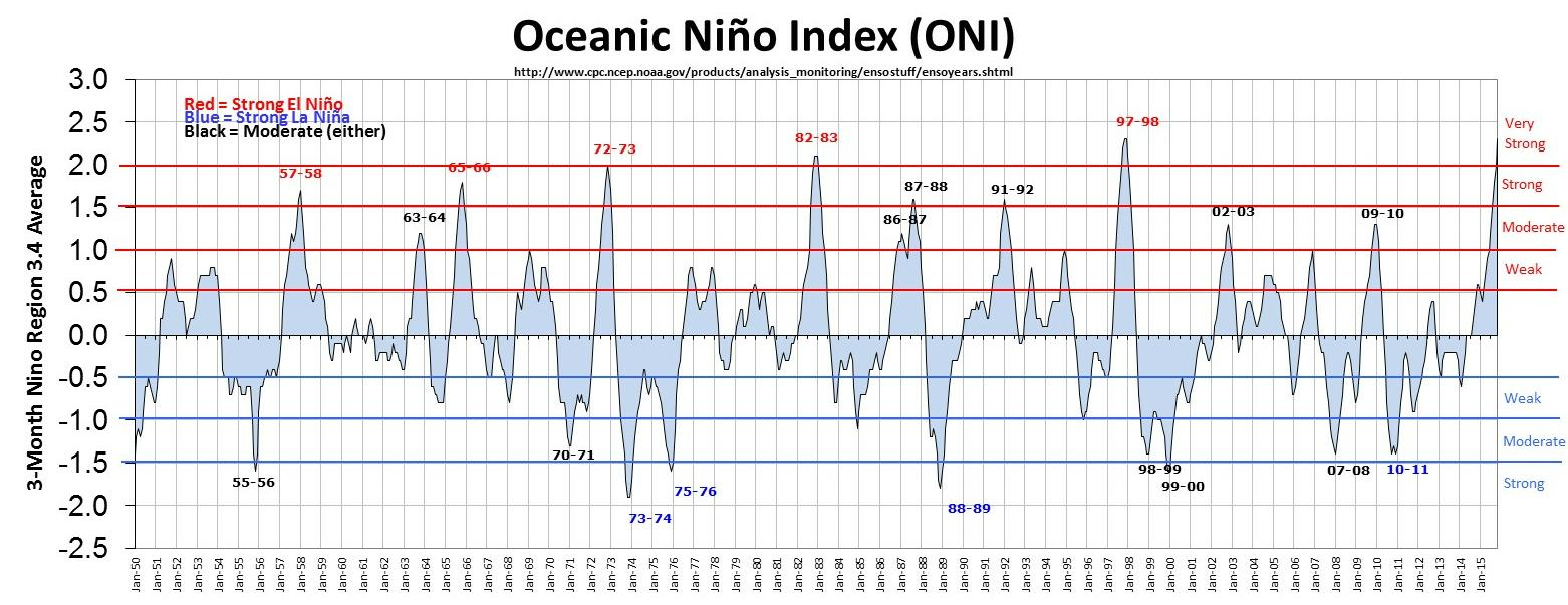
| Changing Jet Stream Influences Hydrology | ||
 |
 |
Related Information West Texas Mesonet click-able weather station map NWS Guads Weather Info
|
||
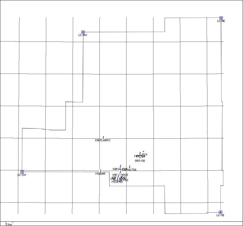
Lincoln County |
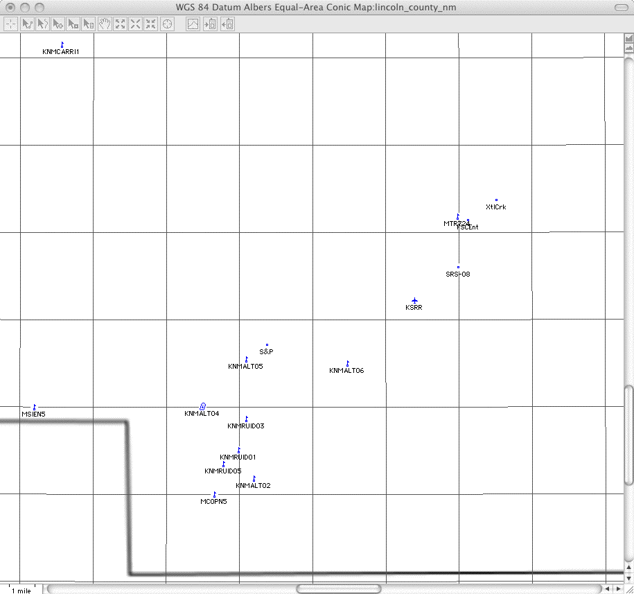
Detail around FSC |
Rev. 5-30-2019 |
Comments to the webmaster |
Contact the FSCSP President |
Contact the Project Director |