Photos#2 from the Fort Stanton Cave Study Project
Photos#2 from the Fort Stanton Cave Study Project |
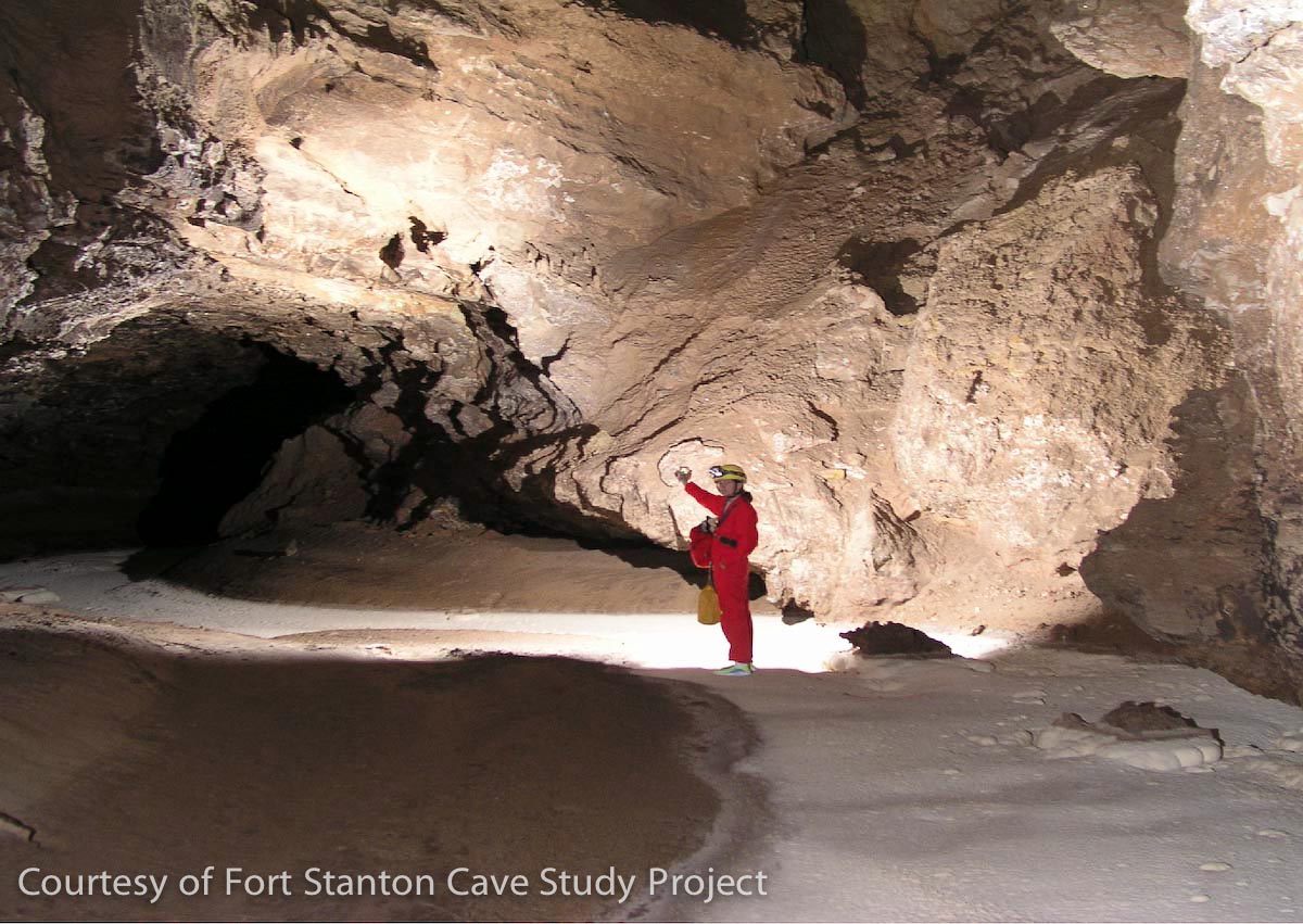
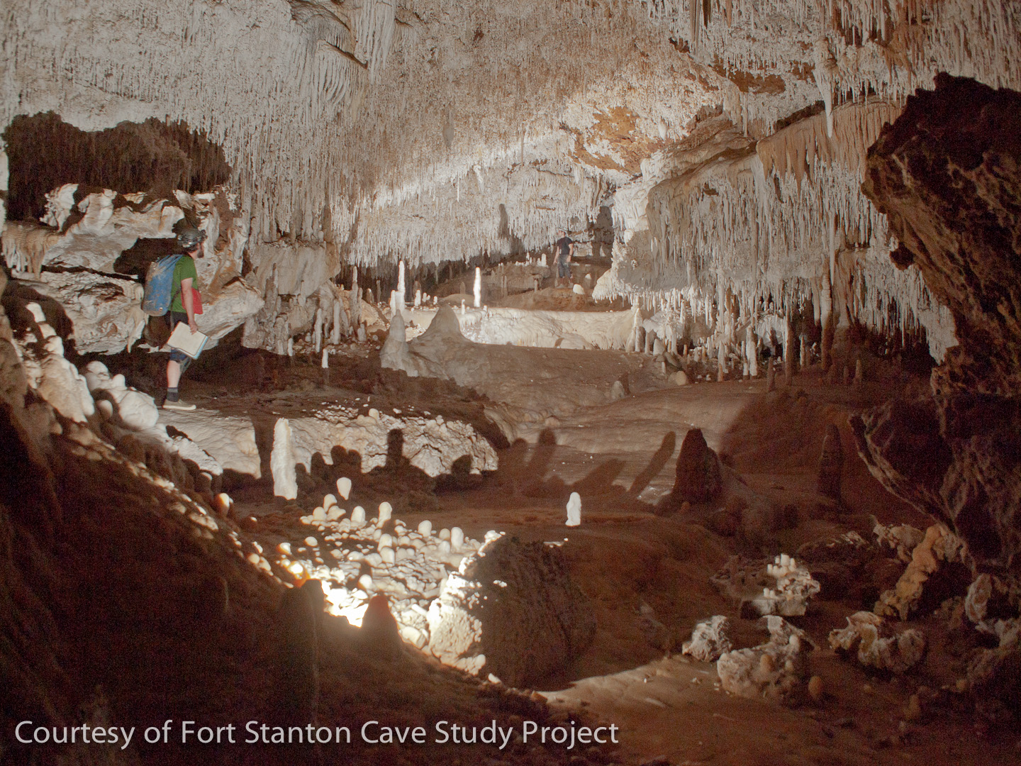
The Snowy River Passage, discovered in 2001, is now thought to have the longest cave formation in the world. It was caused by intermittent flowing waters that left the white calcite formation on the floor shown in this photo. Kat Rix lights the passage at SRN 12, located under an upper Window passage. Although the full extent of Snowy River is unknown, the passage has been surveyed over 10 miles in length. During the three times we have seen water flowing in this passage since the original discovery, we believe that the average depth is only around six inches. Research on the unique passage continues both underground and above-ground using sophisticated measurement techniques. John Ganter Photo.(Click on the picture to view a larger image.) |
 |
|
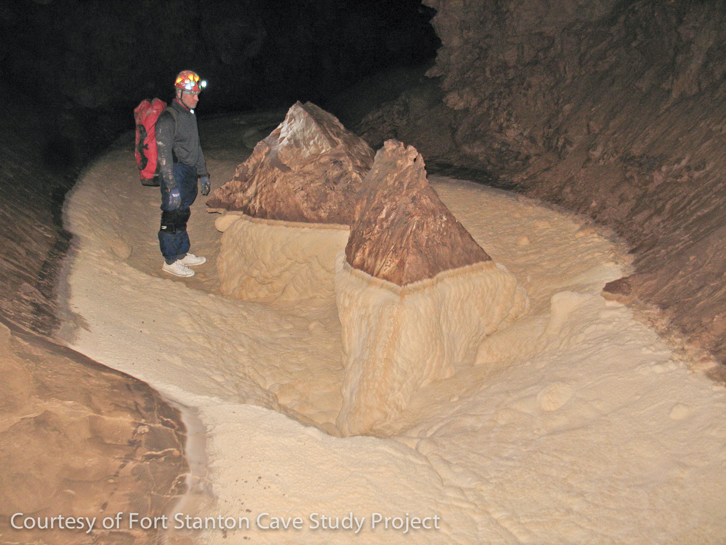
Taken in October, 2011, an amazing feature located five miles from the entrance in far south Snowy River resembles two mountainous islands. Although somewhat similar to some smaller objects in the area near Turtle Junction, the team designated this area as the "Realm of the Floating Islands". Tim George inspects this set of twin peaks which only become islands during the time that Snowy River is flowing. A water logger was installed at this location to monitor the future flows of Snowy River.(The Snowy River passage is currently only open to scientists who are studying and surveying the cave.) Jim Goodbar Photo. |
 |
|
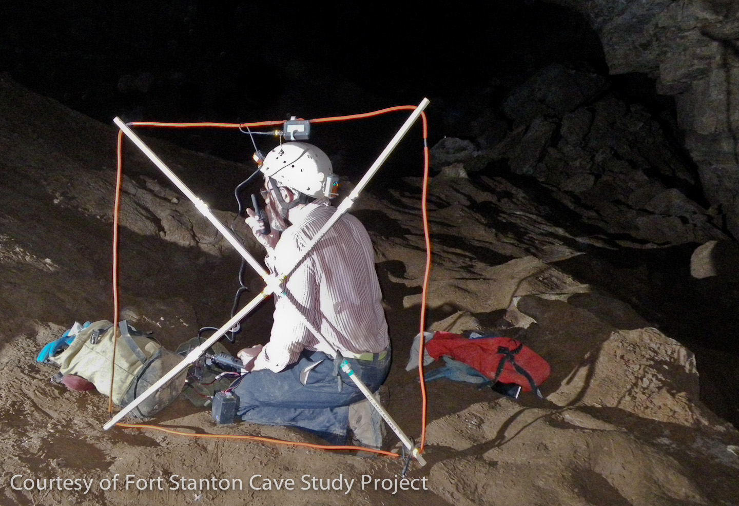
Bob Buecher testing a cave radio horizontal range through the Main Corridor of the cave. (Normally the loop antenna would be positioned level with the ground for optimum communication with a team on the surface.) During the initial survey and exploration of the "near" sections of Snowy River, these radios were used for communications between the surface and the teams in the cave. However, this is impractical at the far extent of the passages due to the extra size and weight of the radio pack. A different beacon antenna and radio are also being used to enhance the precision of our surveys in some of the remote passages by locating surface locations that can be precisely measured with GPS technology. Pete Lindsley Photo. |
 |
|
Snowy River passage just a few stations south of the Turtle Junction changing area. It shows the extent of the white calcite coatings that form (only when Snowy River is running) on fingers of rock that extend into the main passage. Teams that visit this portion of the passage must change into clean clothing and footwear and take great care to not scuff their feet on the delicate floor crystals. If they drop a bit of mud onto the pristine white surface they immediately have to clean up the dirt so that future visitors will not grind it into the white surface. Once the water flows over such an area another small deposit of calcite covers the floor preventing easy removal of the dirty area. Pete Lindsley Photo. |
||
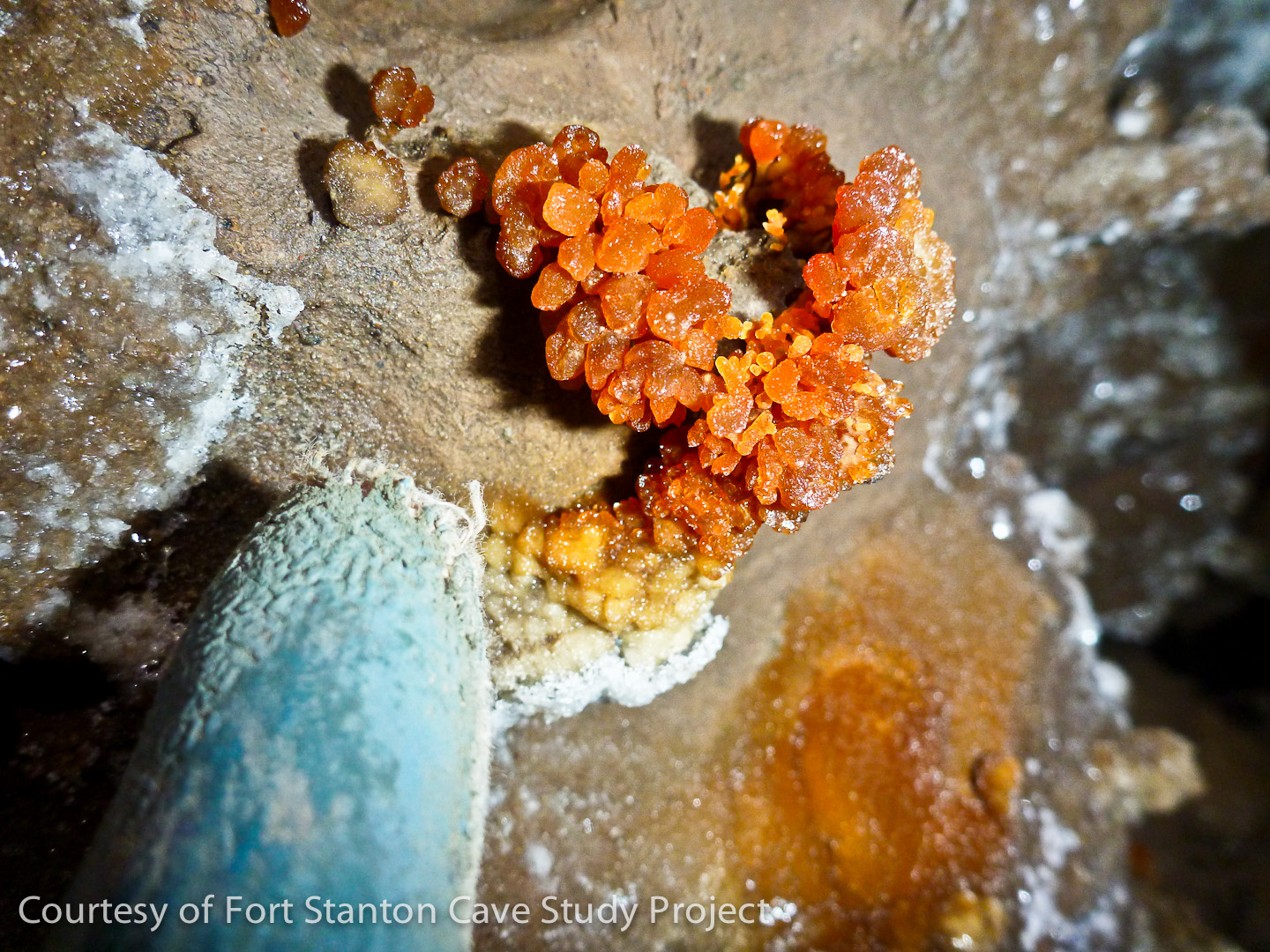
This tiny yellow calcite formation is an example of some of the unique formations being discovered at the far south end of the Snowy River part of the cave. Located about knee high on the wall of a passage just past Midnight Junction, the team called the ball-shaped formation "Lemon Head". Midnight Junction is one of the few locations where side passages are found in Snowy River that are apparently in-feeders or tributaries to the 10+ mile long Snowy River. Although the white-floored Snowy River passage continues at this point, we are finding some of the best examples of other beautiful formations and fossils in the whole cave. John Lyles Photo. |
||
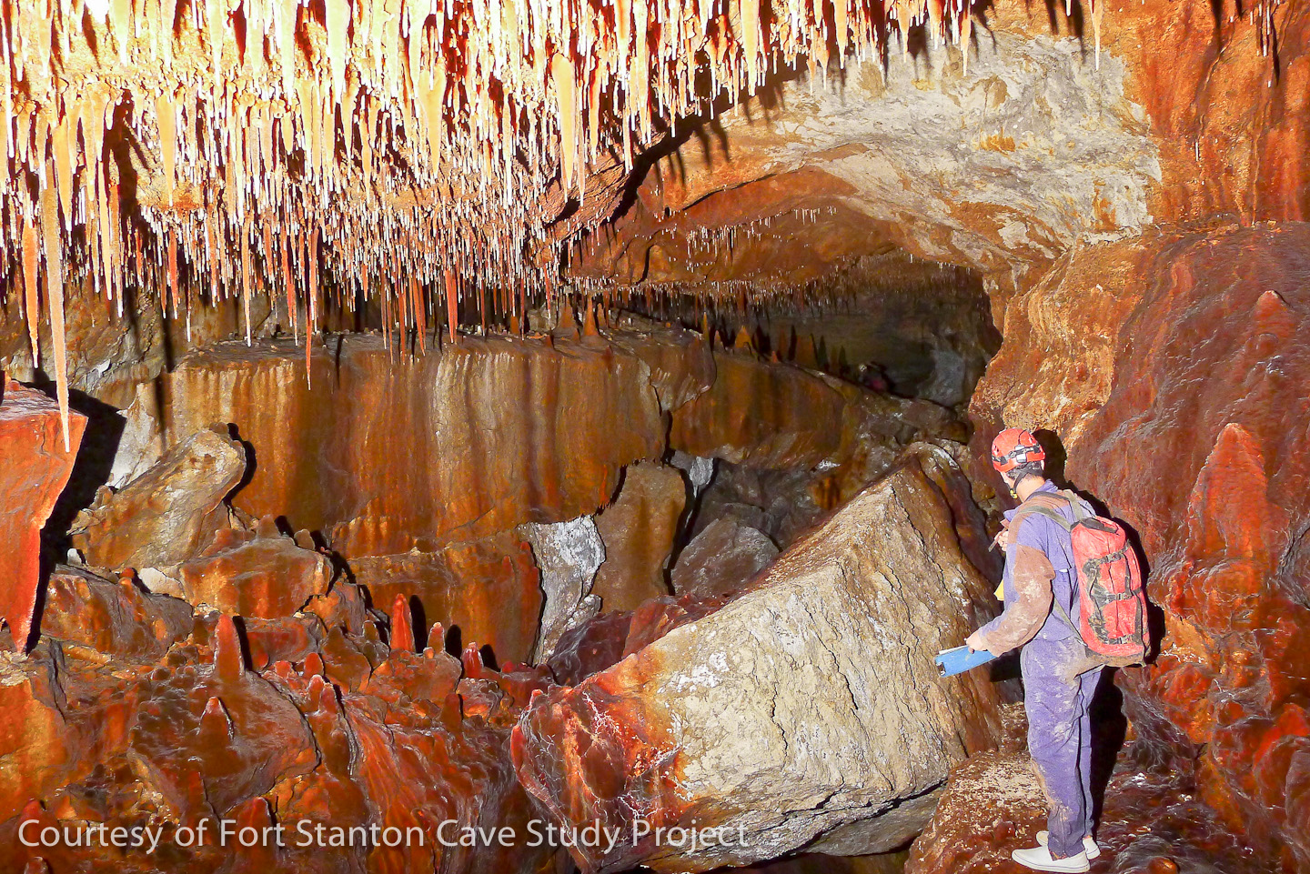
In the Red Velvet Passage, Stan Allison sketches some of the amazing red colored calcite found in the tributaries to Snowy River past Midnight Junction. Survey teams alternate many times between "clean" and "dirty" modes when traveling to these remote areas. Using a combination of shoes and shoe covers, dirty pack covers for protecting clean packs, and clothes changes including knee and elbow pads, the majority of these trips are lasting between 30 and 40 hours in length and the total in-and-out passage length is equivalent to running a marathon with a 40 pound pack! Garrett Jorgensen Photo. |
 |
|
One of many Brachiopod fossils found in a ceiling layer of limestone in the Midnight Creek passage is a real jewel. Midnight Creek is one of the tributaries reached via Midnight Junction and actually had a 1 inch deep flowing trickle of water for over 50 feet when this photo was taken in May, 2013. Normally the delicate spines on these fossils are destroyed by erosion, but in the cave environment it is not unusual to find very delicate features still intact. Shawn Thomas Photo. |
 |
|
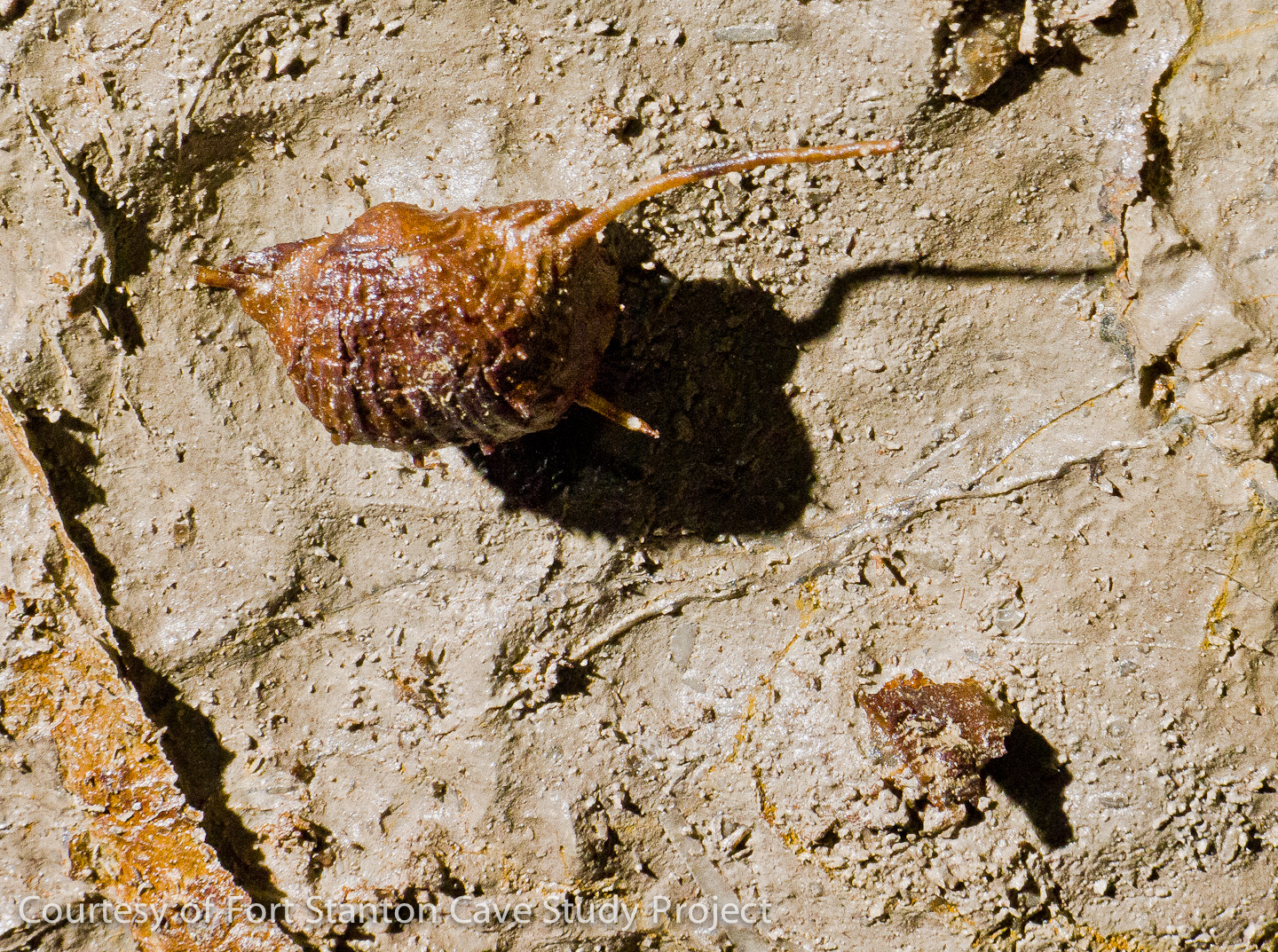
A beautiful ring for a finger? No, but a tattered glove provides a scale for this unique orange colored calcite formation found on a wall in a section of the cave just beyond Midnight Junction. Jennifer Foote Photo. |
||
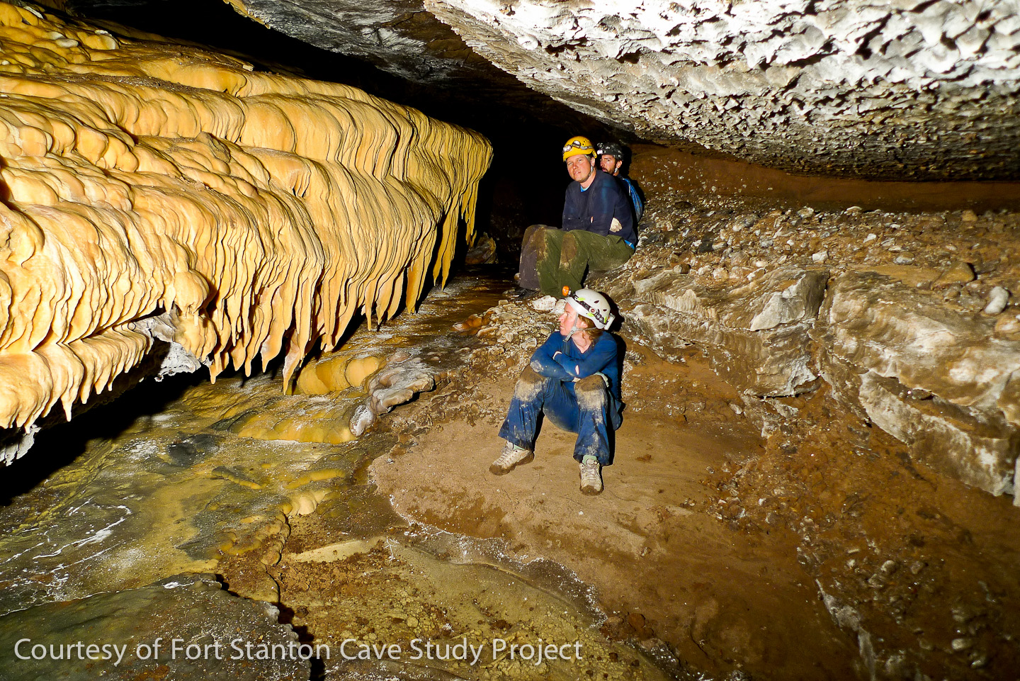
This beautiful area near station MK75 is called "Borderlands", discovered July 13, 2013. The hydrological exploration and survey team consisted of G. Jorgensen, J. Hunter, A. Armstrong and S. Thomas. The survey sketcher (on the left) has his difficult job defined with the point person visible at the far end of the highly decorated room. James Hunter Photo. |
 |
|
Flowstone Cascade is located in the Midnight Creek passage (front to back: J. Foote, A. Armstrong & S. Thomas). John Lyles Photo |
 |
![]()
Rev. 5-3-2020 |
Comments to the webmaster |
Contact the FSCSP President |
Contact the Project Director |