| Home Page | About Us | Contact Us | Participation | Privacy Policy | ©2024 Ft. Stanton Cave Study Project
Rev. 8-1-24 |
Comments to the webmaster |
Contact the FSCSP President |
Contact the Project Director |
| Hydrogeology | Rio Bonito1| Government Spring | Eagle1 | Eagle2 | Fire & Smoke Map |
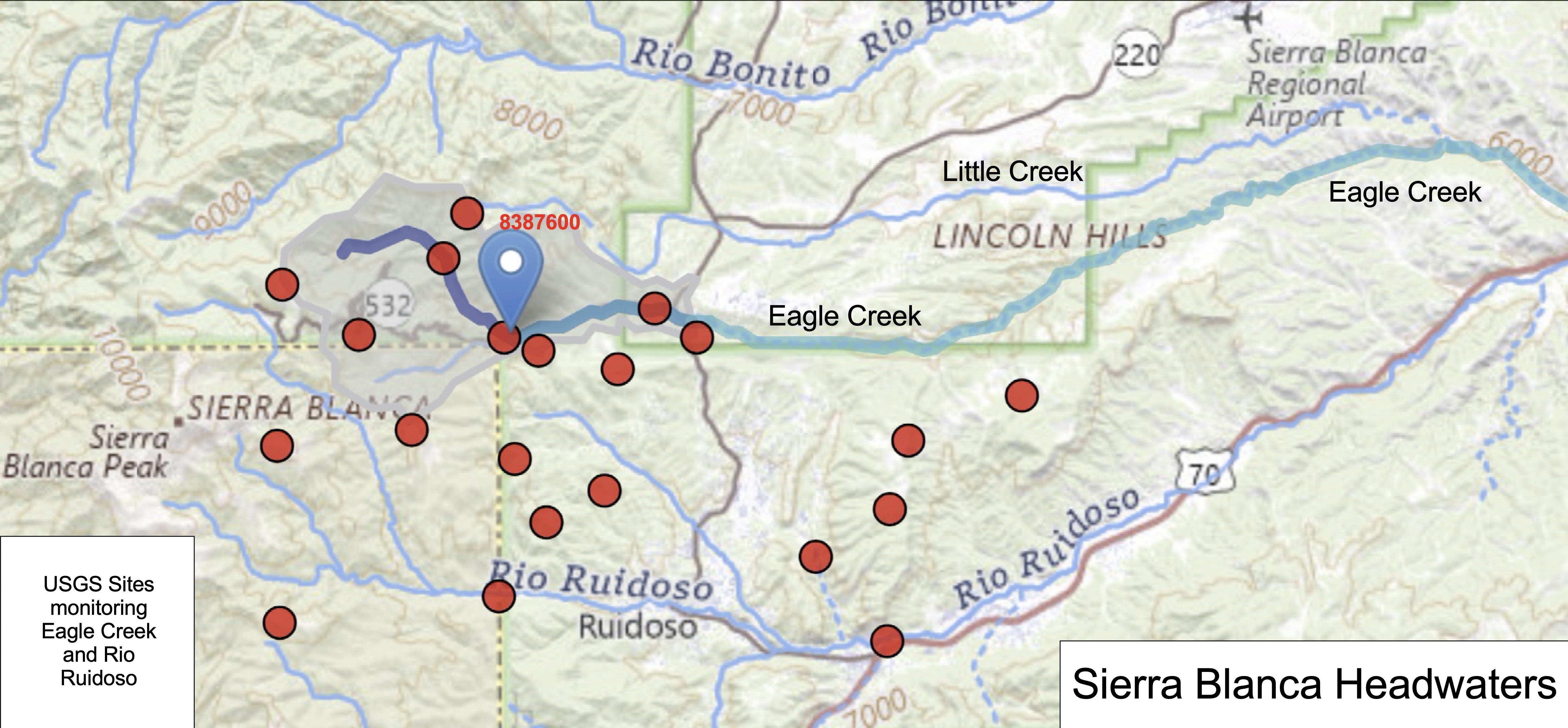
Sierra Blanca Peak collects snow and water which then feeds several creeks and larger streams. From top to bottom they are the Rio Bonito, Little Creek, Eagle Creek and the Rio Ruidoso. Currently evidence supports the theory that the Rio Bonito supplies the water in the Main Corridor of Fort Stanton Cave, and Eagle Creek is the primary source of the water in the Snowy River Passage. The map above suggests that different areas of Sierra Blanca feeds these four surface streams, and that perhaps all four may have contributed to the formation of the passages over the past millions of years. USGS hydrology sites are illustrated by the red dots and the blue tear drop is the primary site currently being used for flow analysis of Snowy River. The table and chart below provide links to some of these USGS sites. |
---|
Name |
Site No. |
Sample Charts |
Detail URL |
Rio Ruidoso at Ruidoso, NM |
|||
South Fork Cedar Creek near Ruidoso, NM |
|||
Cedar Creek above Ruidoso, NM |
|||
Gavilan Canyon at Skunk Canyon NR Hollywood, NM |
|||
Rio Ruidoso at Hollywood, NM |
|||
North Fork Eagle Creek near Alto, NM |
|||
South Fork Eagle Creek near Alto, NM |
|||
Eagle Creek below South Fork near Alto, NM |
|||
Eagle Creek at Alto, NM |
|||
Alto Reservoir at Alto, NM |
|||
Rio Bonito near Fort Stanton, NM |
|||
Rio Bonito near Lincoln, NM |
|||
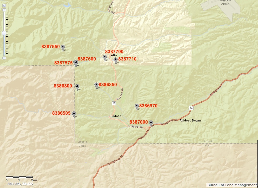
In 2024, just before the South Fork and Salt Fires, the USGS started adding additional sites which are shown in the table above and the chart below. Some of these sites were compromised by the following flash flooding and large amounts of foreign materials, and these sites may take several months to come back on-line. Most of the sites have graphs available for certain parameters and examples from August 1, 2024 are shown for the 2-month period starting just days before the destructive forest fire that created significant flooding in some streams as well as deposits of fire ash and extremely muddy water flows. Interested readers are encouraged to check out the USGS web sites and especially the legacy web site graphs available in many cases. |
---|
Work in Progress continues with new 2024 Information - Please check back later
Rev. 8-1-24 |
Comments to the webmaster |
Contact the FSCSP President |
Contact the Project Director |