Fort Stanton Cave Study Project
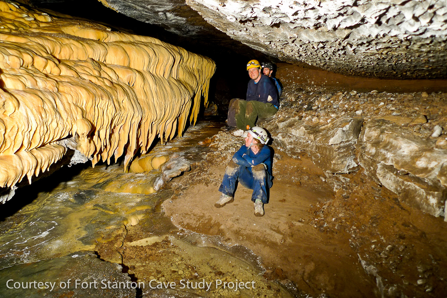
The banner picture above (Photo by John Cochran) shows a portion of Snowy River, located below an upper level passage called The Metro, located just North of Turtle Junction which is a mile from the single entrance. The Fort Stanton Cave Study Project (FSCSP) is a private, non-profit organization under section 501(c)(3) of the IRS code. Our mission is to conduct and promote exploration, public education, scientific research, and environmentally sound management of the caves and karst within and surrounding the Fort Stanton – Snowy River Cave National Conservation Area.
The FSCSP, comprised of over 100 volunteers with the spirit of "volunteerism", has been pursuing these activities for over 55 years, taking Fort Stanton Cave from a well-known popular recreational cave, to a world class, scientifically extraordinary, 83 Kilometer system as of October 2024. The discovery of the famed Snowy River passage in 2001 is one of the most significant achievements of this organization. Now, in what is likely the most remote (from an entrance) underground area in the world, over 12 miles south from the Turtle Junction location, our teams plan to continue the exploration and survey of several Snowy River tributaries and upper levels. The project sponsors two, week-long expeditions yearly and our policy is to be fully open to all individuals interested in furthering the goals of the project.
 In the fall of 2024 we celebrated reaching the 50-mile long milestone. Our recent history is covered in more detail HERE.
FSCSP Expedition Schedule 2025 Expeditions:
The project currently sponsors two, week-long expeditions yearly. Fort Stanton Cave, an extensive limestone cave in central New Mexico, is currently the second-longest cave in the state and is important because of the discovery of the Snowy River passage which was found to have flowing water during certain times. Team members in the "Strong & Light" category are continuing the far south exploration surveys on extended bivouac and camp trips. Other day trips are currently supporting science and photogrammetry projects in the cave, and surface resistivity and ridge-walking trips in the area.
|
|
|
Fort Stanton Cave
|
|
|
|
2025 Expeditions |
| |
Expect special Covid-19 rules to be followed:
|
|
|
|
|
| |
|
|
|
|
January 6, 2025 |
| |
Spring Expedition |
|
|
|
May 10 - May 18, 2025 |
| |
Please contact Ron Lipinski for details on Potential Summer Mini-Expeditions |
|
|
|
June - August, 2025 |
|
|
Fall Expedition |
|
|
|
|
Fort Stanton Cave Area
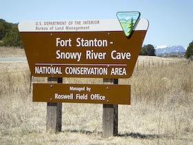
The Fort Stanton-Snowy River Cave National Conservation Area (NCA) is a significant natural, cultural and historical resource located in the south-central part of New Mexico in Lincoln County, between the villages of Lincoln and Capitan. The 25,000+ acres of public land administered by the Bureau of Land Management (BLM) was designated the Fort Stanton-Snowy River Cave National Conservation Area in 2009. Our many volunteers have worked in the cave for over 65 years with emphasis on scientific research, exploration, conservation and public outreach. In particular, we work with multiple partners including scientists in Universities, the BLM, the USFS, and the USGS.
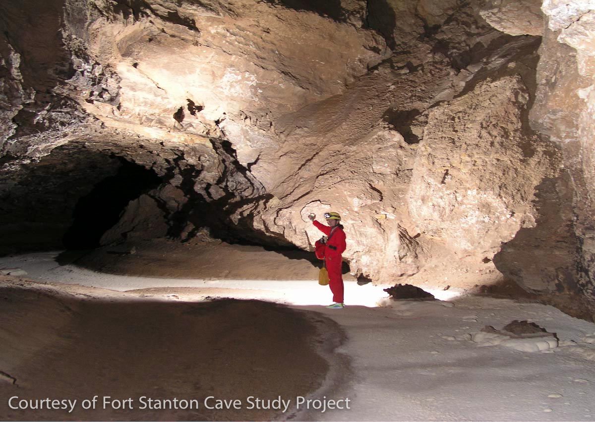
Fort Stanton Cave, an extensive limestone cave in central New Mexico, is currently the second-longest cave in the state and is important because of the discovery of the Snowy River passage which was found to have flowing water during certain times. Modern-day cavers have been exploring Fort Stanton Cave passages for over 50 years and continue their explorations and study as part of the Fort Stanton Cave Study Project (FSCSP). Team members in the "Strong & Light" category are continuing the far south hydrological surveys on extended bivouac and camp trips past Midnight Junction, so named because when discovered it was midnight during a 30+ hour long trip. Currently the far end of the Snowy River Passage is at a place called the "Hanging Gardens". At the end of each caving season the FSCSP publishes a limited edition calendar featuring new areas of work, and is available to our team members and other interested supporters. There is a panorama photo at the Priority 7 junction with Snowy River, the location where Snowy River was discovered 24 years ago!
 |
|
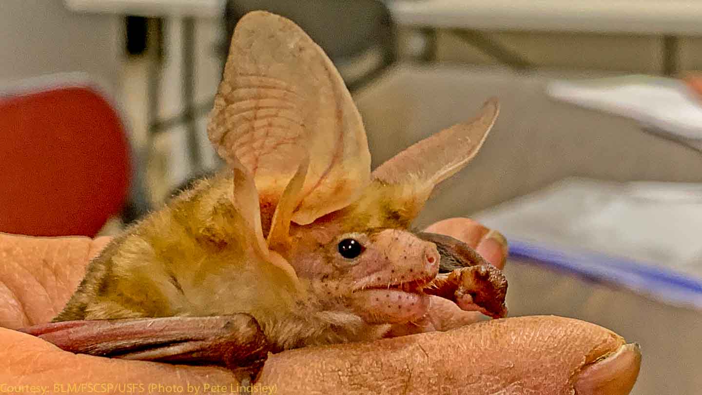
Bats are our Friends
The FSCSP supports bats and the science involving bats. BUT DO NOT TOUCH WILD BATS found in the wild! This little Pallid bat is a rescue bat, unable to fly, and is being fed a meal worm by one of our bat scientists. Please take time and click here to learn the real story about our friend the bat, which can also be found under bridges and in buildings, not just caves. The FSCSP follows the WNS rules and supports the scientists taking measurements on our local New Mexico bat populations. |
| |
|
|
| Selected photos are shown below |
| |
|
|
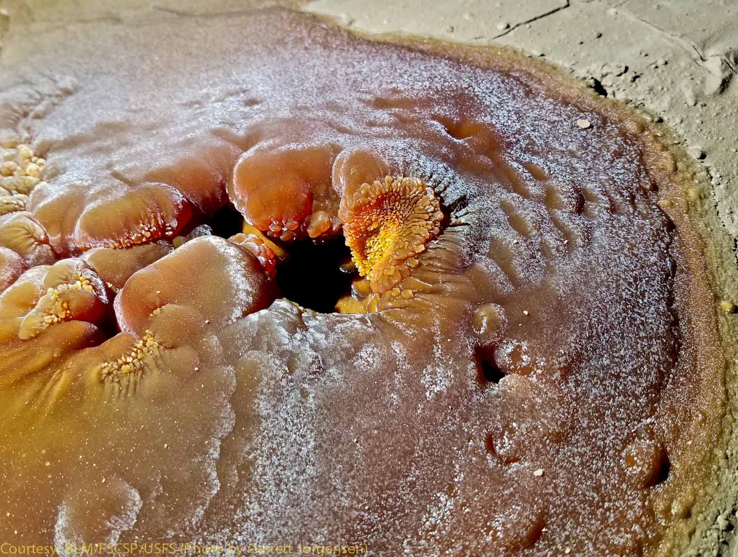
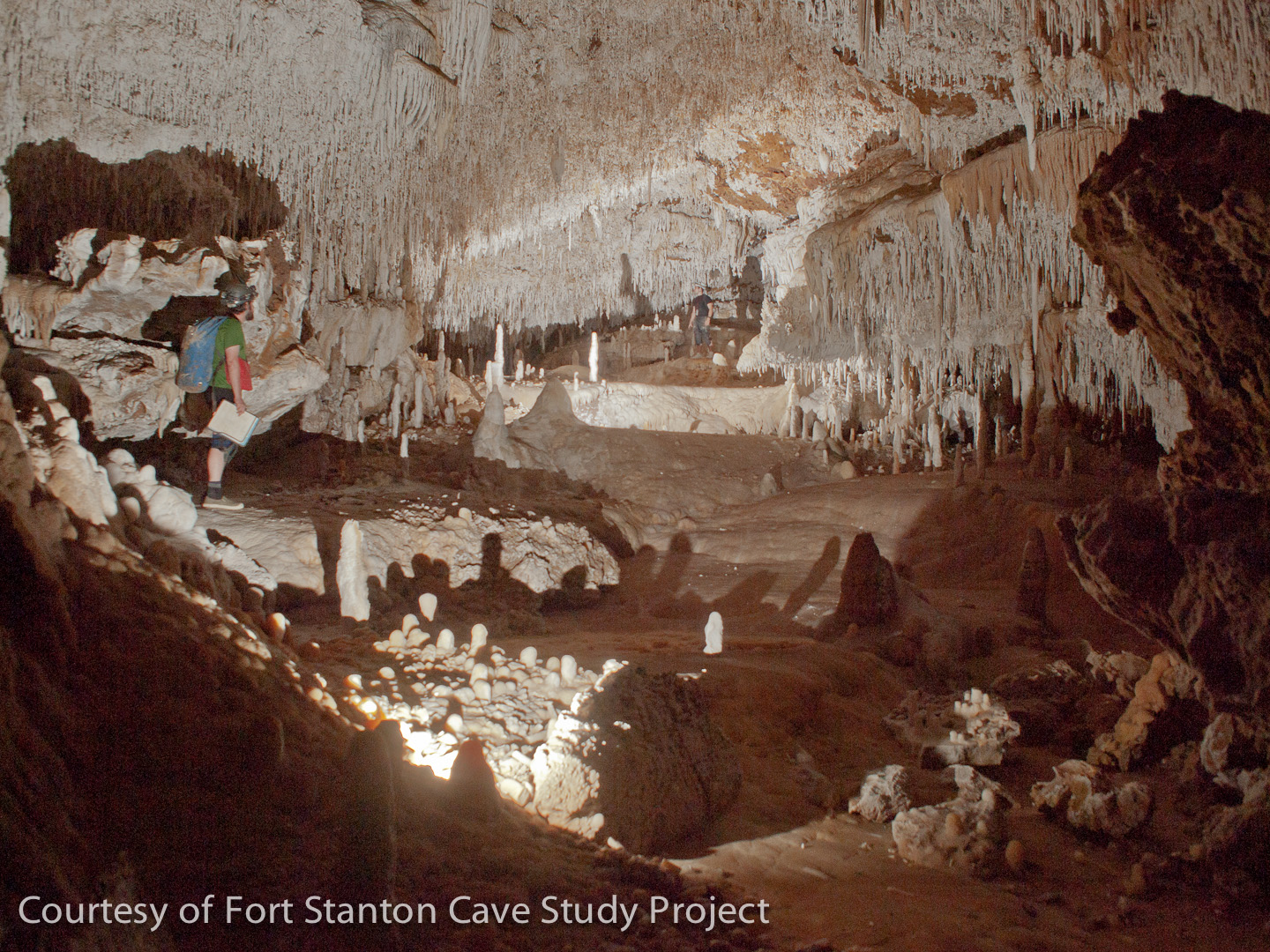
This beautiful calcite formation in Capitan Caverns was found on the floor under a drip from above. (Garrett Jorgensen photo) |
|
|
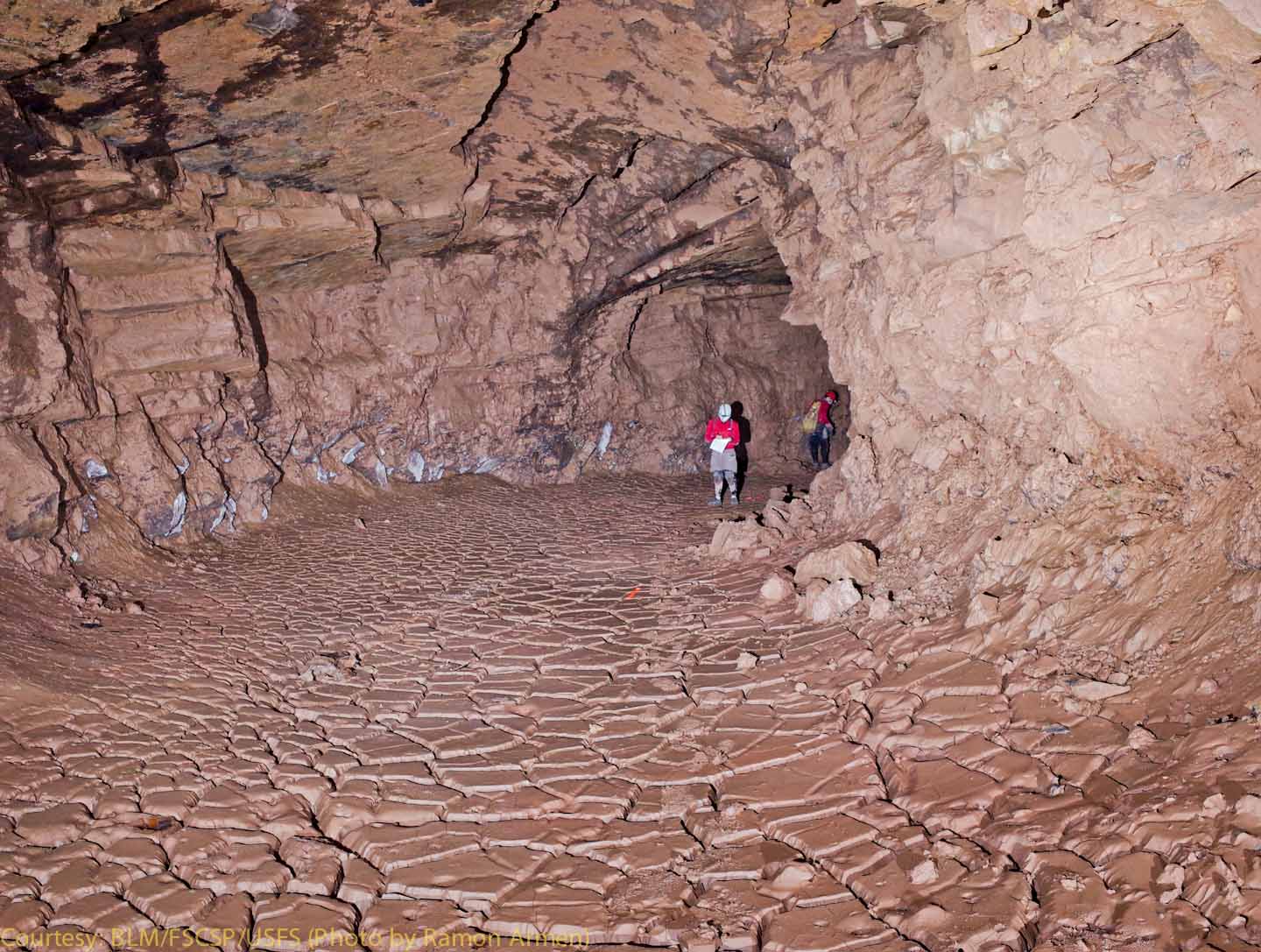
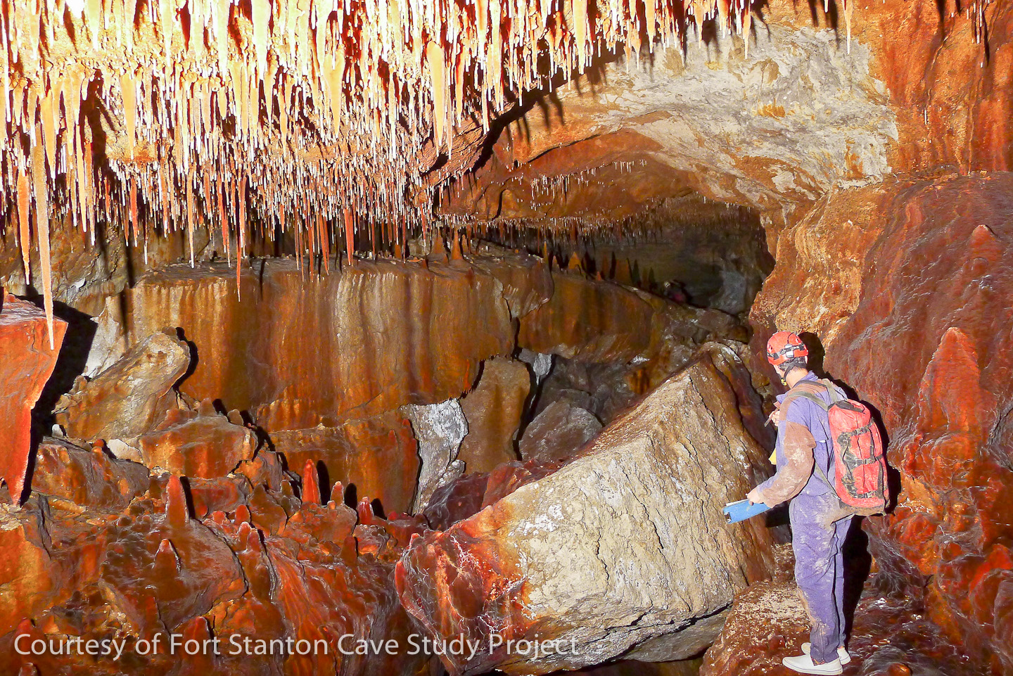
This low-level passage at the north end of Capitan Caverns is displaying exquisite mud cracks. This area is near Capitan Gap, and is a lower level corresponding to the Tiger Tail Room in Lincoln Caverns, discovered over 50 years ago. These mud cracks are especially well preserved due to the lower passage being shielded from the strong airflow through the main segments of Capitan Caverns. (Ramon Armen photo) |
|
|
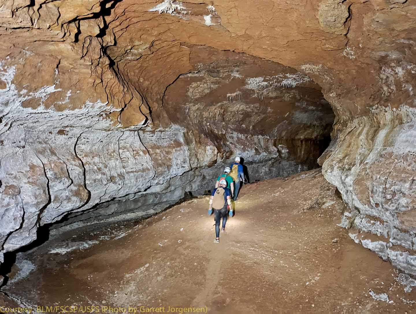
Nick Anderson, Adam Weaver and Jason Ballensky traveling through the Super Borehole passage in far south Capitan Caverns. (Garrett Jorgensen photo) |
|
|
The Snowy River Passage, discovered in 2001, is now thought to have the longest cave formation in the world. It was caused by intermittent flowing waters that left the white calcite formation on the floor shown in this photo. Kat Rix lights the passage at SRN 12, located under an upper Window passage. Although the full extent of Snowy River is unknown, the passage has been surveyed over 10 miles in length. During the three times we have seen water flowing in this passage since the original discovery, we believe that the average depth is only around six inches. Research on the unique passage continues both underground and above-ground using sophisticated measurement techniques. John Ganter Photo.
(Click on the picture to view a larger image.)
|
|
|
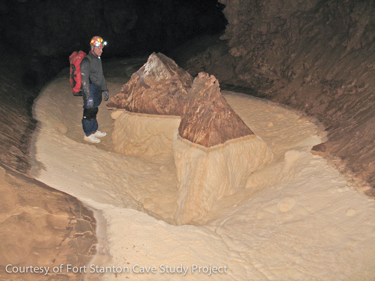
Taken in October, 2011, an amazing feature located five miles from the entrance in far south Snowy River resembles two mountainous islands. Although somewhat similar to some smaller objects in the area near Turtle Junction, the team designated this area as the "Realm of the Floating Islands". Tim George inspects this set of twin peaks which only become islands during the time that Snowy River is flowing. A water logger was installed at this location to monitor the future flows of Snowy River.
(The Snowy River passage is currently only open to scientists who are studying and surveying the cave.) Jim Goodbar Photo.
|
|
|
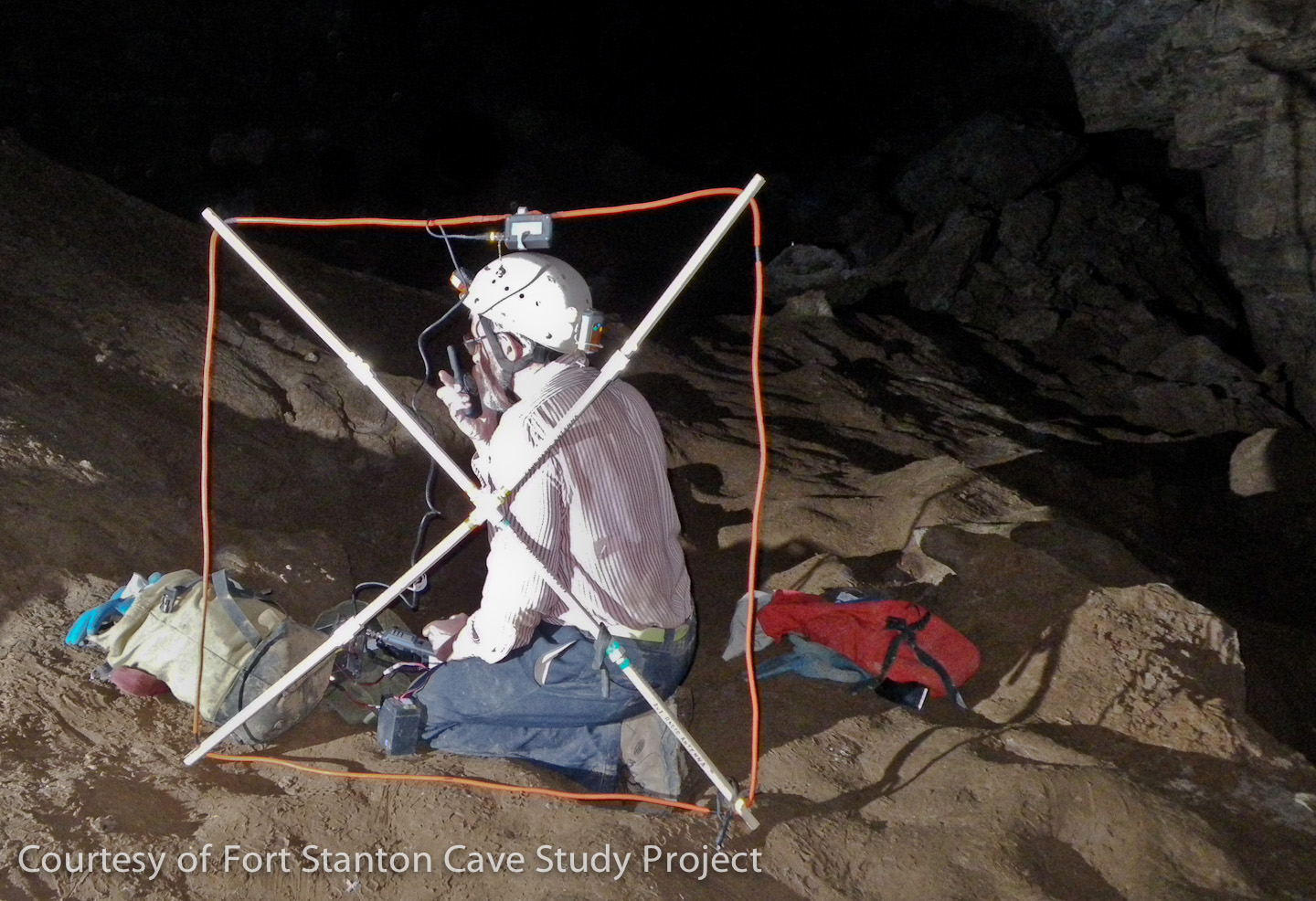
Bob Buecher testing a cave radio horizontal range through the Main Corridor of the cave. (Normally the loop antenna would be positioned level with the ground for optimum communication with a team on the surface.) During the initial survey and exploration of the "near" sections of Snowy River, these radios were used for communications between the surface and the teams in the cave. However, this is impractical at the far extent of the passages due to the extra size and weight of the radio pack. A different beacon antenna and radio are also being used to enhance the precision of our surveys in some of the remote passages by locating surface locations that can be precisely measured with GPS technology. Pete Lindsley Photo.
|
|
|
Snowy River passage just a few stations south of the Turtle Junction changing area. It shows the extent of the white calcite coatings that form (only when Snowy River is running) on fingers of rock that extend into the main passage. Teams that visit this portion of the passage must change into clean clothing and footwear and take great care to not scuff their feet on the delicate floor crystals. If they drop a bit of mud onto the pristine white surface they immediately have to clean up the dirt so that future visitors will not grind it into the white surface. Once the water flows over such an area another small deposit of calcite covers the floor preventing easy removal of the dirty area. Pete Lindsley Photo. |
|
|
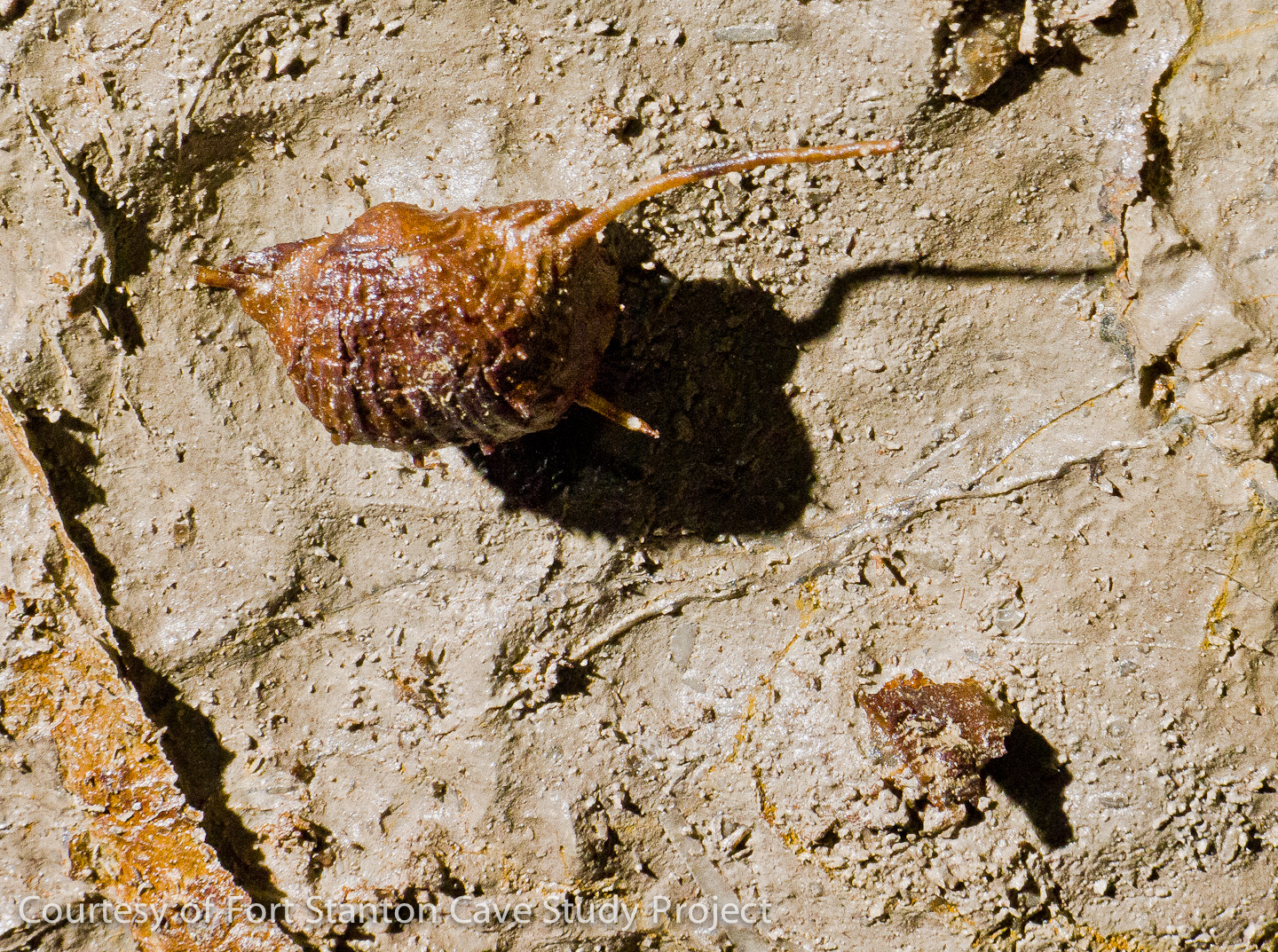
This tiny yellow calcite formation is an example of some of the unique formations being discovered at the far south end of the Snowy River part of the cave. Located about knee high on the wall of a passage just past Midnight Junction, the team called the ball-shaped formation "Lemon Head". Midnight Junction is one of the few locations where side passages are found in Snowy River that are apparently in-feeders or tributaries to the 10+ mile long Snowy River. Although the white-floored Snowy River passage continues at this point, we are finding some of the best examples of other beautiful formations and fossils in the whole cave. John Lyles Photo.
|
|
|
In the Red Velvet Passage, Stan Allison sketches some of the amazing red colored calcite found in the tributaries to Snowy River past Midnight Junction. Survey teams alternate many times between "clean" and "dirty" modes when traveling to these remote areas. Using a combination of shoes and shoe covers, dirty pack covers for protecting clean packs, and clothes changes including knee and elbow pads, the majority of these trips are lasting between 30 and 40 hours in length and the total in-and-out passage length is equivalent to running a marathon with a 40 pound pack! Garrett Jorgensen Photo.
|
|
|
One of many Brachiopod fossils found in a ceiling layer of limestone in the Midnight Creek passage is a real jewel. Midnight Creek is one of the tributaries reached via Midnight Junction and actually had a 1 inch deep flowing trickle of water for over 50 feet when this photo was taken in May, 2013. Normally the delicate spines on these fossils are destroyed by erosion, but in the cave environment it is not unusual to find very delicate features still intact. Shawn Thomas Photo.
|
|
|
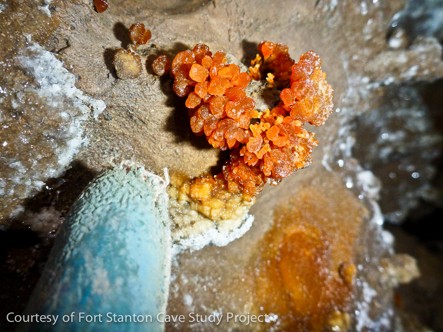
A beautiful ring for a finger? No, but a tattered glove provides a scale for this unique orange colored calcite formation found on a wall in a section of the cave just beyond Midnight Junction. Jennifer Foote Photo.
|
|
|
This beautiful area near station MK75 is called "Borderlands", discovered July 13, 2013. The hydrological exploration and survey team consisted of G. Jorgensen, J. Hunter, A. Armstrong and S. Thomas. The survey sketcher (on the left) has his difficult job defined with the point person visible at the far end of the highly decorated room. James Hunter Photo.
|
|
|
Flowstone Cascade is located in the Midnight Creek passage (front to back: J. Foote, A. Armstrong & S. Thomas). John Lyles Photo
|
|
|
| |
|
|
Battle For Bats: Surviving White Nose Syndrome
Project Area
|
Fort Stanton - Snowy River Cave National Conservation Area (NCA)
Following the discovery of Snowy River in 2001, the BLM and our researchers worked to create a special designation for this unique resource. In 2005 a special congressional trip visited Snowy River and reviewed material for the site proposal. In 2009 the area around Ft. Stanton Cave was made into a designated National Conservation Area (NCA) with more than 25,000 acres in order to protect this new resource. The new NCA is managed by the Bureau of Land Management out of the Roswell Field Office The FSCSP is affiliated with the Conservation Lands Foundation, and is an official Project of the National Speleological Society.
|
History of Exploration
Ft. Stanton Cave, NM, is located just northeast of the historic Fort Stanton near Capitan, NM. Signatures show that the soldiers were exploring the front part of the cave back in the mid-19th century. We have also found evidence that American Indians (Jornada Mogollon and Apache) may have explored the cave using cane torches before the soldiers. Modern-day cavers dug into a unique passage they named Snowy River and so far have explored it over 12 miles. Snowy River is a large, mostly level ancient stream passage that has a pure white calcite floor that runs the length of the passage. Due to the delicate nature of the floor channel coating that varies from fractions of an inch to perhaps four inches in thickness, explorers take special care to keep the formation clean and to minimize damage. In 2007 the cavers discovered that Snowy River occasionally has clear water flowing through the passage, its maximum depth defined by the edge of the pure white calcite formation on the mud floor and limestone walls.
Conservation Goals and Objectives
The centerpiece of the Fort Stanton-Snowy River Cave National Conservation Area (FS-SRC NCA) is Fort Stanton Cave and its associated karst system. Our main activity is documenting and protecting this cave and karst system. The information that we gather assists the Bureau of Land Management to better understand the cave and karst resources, manage them, and protect the area. A specific issue that we are trying to understand is the hydrological relationship of the cave to the ground water and surface water resources in the NCA. This relationship is poorly understood at present. We want to make sure that ground and surface water withdrawals in areas near the NCA do not affect the water conditions inside of the cave. Biologists have found the Snowy River passage of Fort Stanton Cave to be a microbiological laboratory of profound significance. A major facet of our mission is to protect and preserve this area. We are just beginning to understand the historic usage of the cave by the local populace starting in the 1850s and before that, the Native Americans. Preserving this evidence is one of our goals. In support of our strong interest of conservation of the resource the FSCSP is working closely with the Conservation Lands Foundation. In case you missed it, the Sunday April 17th issue of Parade Magazine featured a good article "Saving Our National Treasures" that featured some of the unique lands under the BLM National Landscape Conservation System (NLCS).
Additional media: Download Video Here
We currently offer a short video presentation by Jim Cox on the history and exploration of Snowy River
(Please wait for 240 MB mp4 file to load) Check back later - we plan to add additional photographs in 2016.
Interviews |
|
Computer Simulations
|
These photos were part of an update to Caver Quest, an avatar computer simulation of travel through Fort Stanton Cave passages.
|
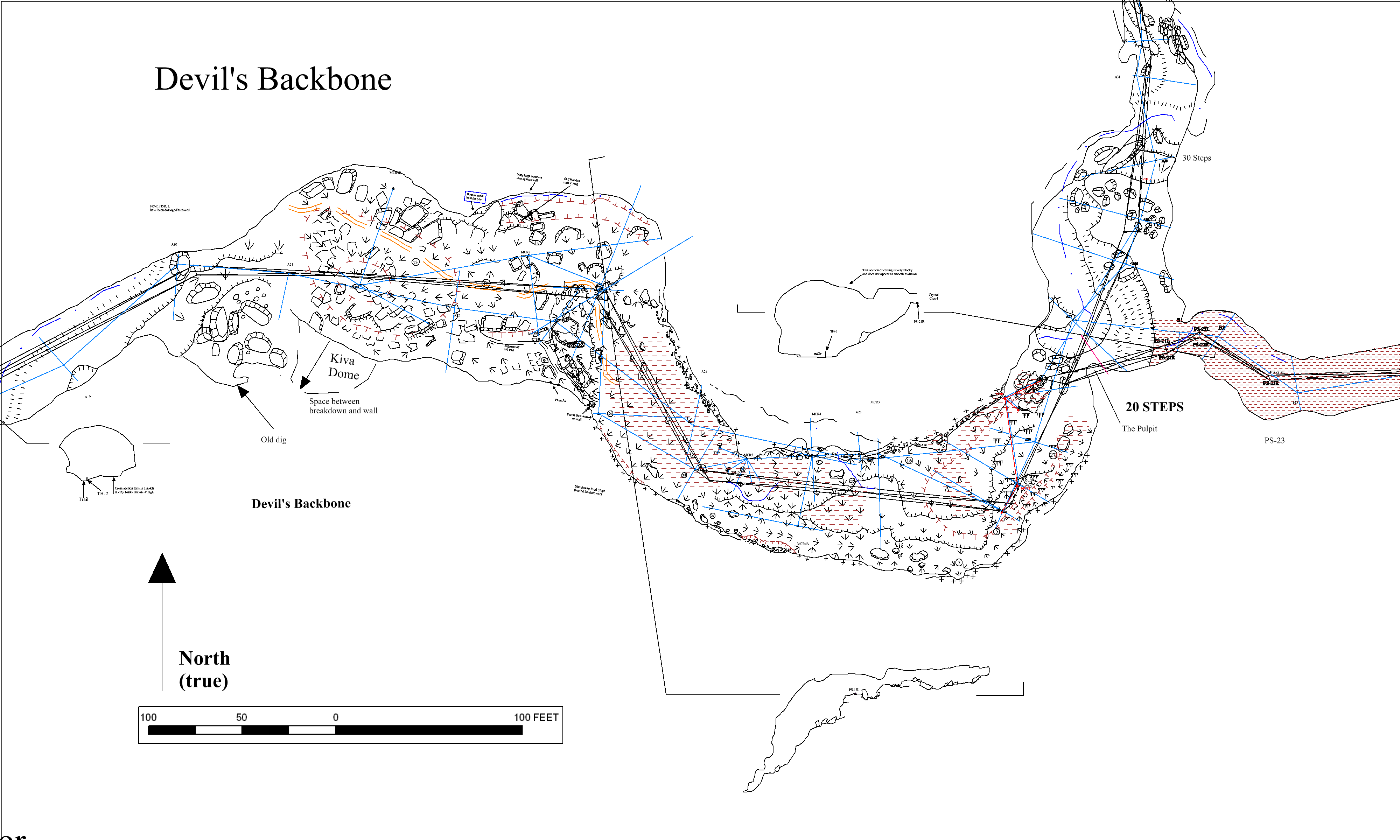
Maps & GIS
Example of Cave Cartography
Devil's Backbone Area of Ft. Stanton Cave
|
|
Map and new graphics for Fort Stanton Museum
|
A 2019 project assisting the BLM with graphics for the updated Fort Stanton Museum cave room is available for visitation during museum hours. With new discoveries and surveys being updated every year, the new surveyed length of the cave is just over 51 miles! In addition to 100% new graphics, the museum now features a new high resolution video showing a survey team in action. A second monitor shows the latest progress of the exploration. Wrapped around a corner at one end of the room is a 7 x 10 foot photo of the Snowy River Passage that provides a visitor a 3-D experience of actually being in the passage itself. The museum is located on the Fort Stanton Quadrangle. |
|
WNS, BLM & USFS Document Links |
|
|
|
| |
|
|
|
|
| |
|
|
|
|
| |
|
2024 Cave Proposals |
|
Proposals to: (BLM_NM_RFO_CAVES@blm.gov)
|

Counterintuitive Free

 | About Us | Contact Us | Participation | Privacy Policy | ©2025 Ft. Stanton Cave Study Project