![]() Home Page
Home Page
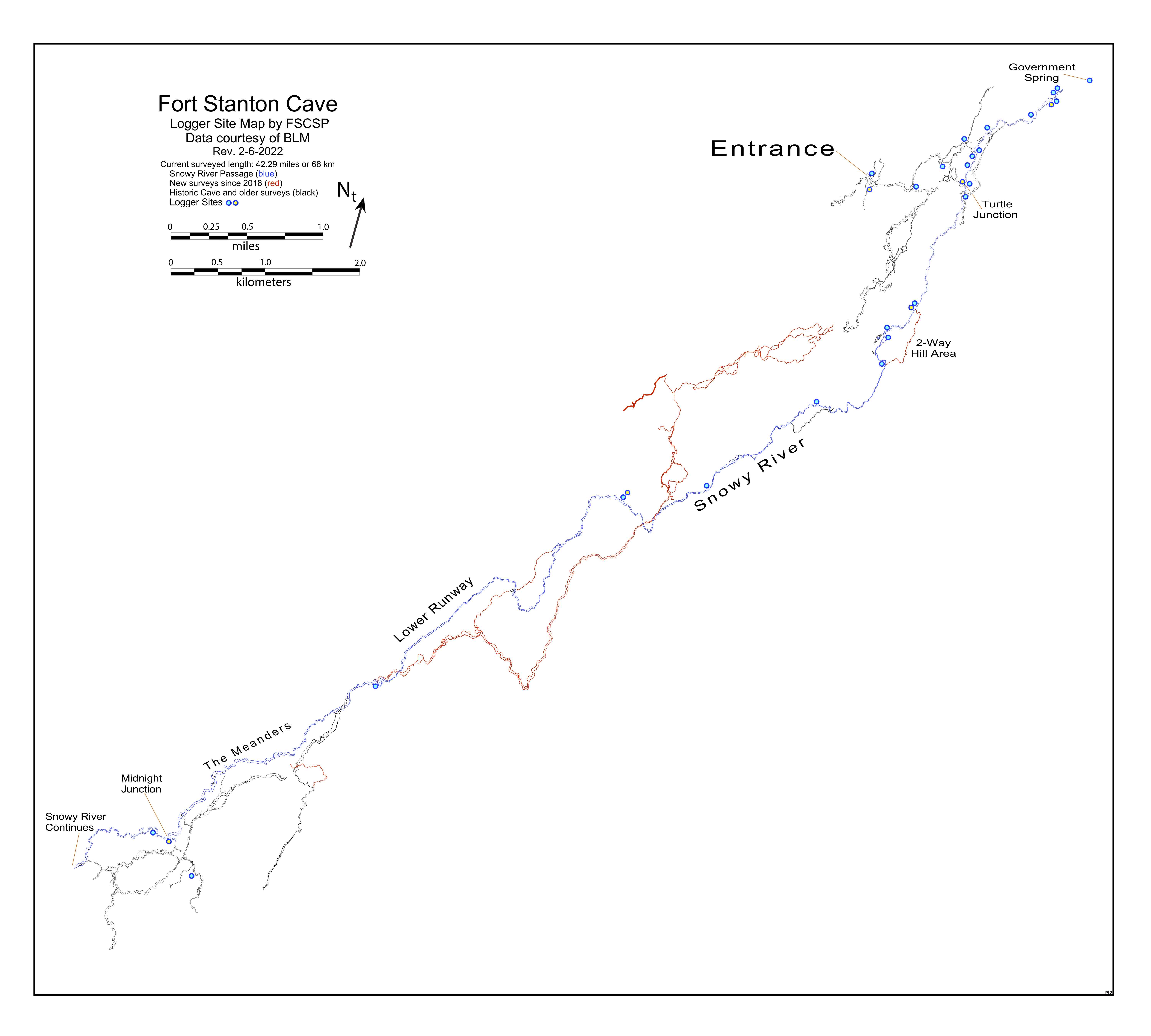
Summary of Data Logger Sites
|
Summary of Data Logger Sites |
Note: You can search for a name or topic by using a control-f (for PCs) or a command-f (for Macs)
|
Logger Sites: |
Water Level Data Logger Sites for Snowy River & Main CorridorThis page lists locations of various loggers "in order" heading south, traveling upstream from the Crystal Creek area at the north end of the cave. The FSCSP loggers are In-Situ Rugged Troll units. The BLM loggers are Solinst loggers.
|
| Eagle2 is a surface site on private property that is being monitored for improved correlation with the source of the water on Eagle Creek that we believe feeds Snowy River in the cave, probably 600 feet below. The near-real-time data is being monitored by a VuLink installation. To see the current data, click on the Eagle2 logger in the lower right box. Then you can select temperature, depth and/or pressure to display. Finally, select the time period you wish to display and choose the units. |
Reports: |
Initial Report: Snowy River Water Flow, June 7, 2011 |
A Decade of Data Logging in Fort Stanton Cave and Snowy RiverThis FSCSP report covers the majority of past data logging in Fort Stanton Cave and Snowy River. As one of longest stream passages in the world monitored by data loggers with only a single cave entrance, you can follow our team's efforts as we extend our knowledge of the local Hydrogeology. As we answer a few of the past questions, we are also finding new questions. Please check back for the latest information.
|
Map of selected data logger sites |
 |
Rev. 1-7-24 |
Comments to the webmaster |
Contact the FSCSP President |
Contact the Project Director |