FSCSP: Future Logger Sites
FSCSP: Future Logger Sites |
Potential Future Logger Sites
Where are the best locations to place loggers in the future? |
||
As our survey teams encounter new areas, especially those with a possible hydrological connection to the Snowy River (Eagle Creek) hydrology or the Main Corridor (Rio Bonito) hydrology zones, they are on a constant lookout for new opportunities. These opportunities not only include hydrology, but also the other sciences such as paleontology, biology, geology and being on the lookout for opportunities of calcite dating naturally broken formations. As possible data logger sites are mentioned by the survey teams and others, they are entered on this list so that all interested parties are able to join in on the discussion. Occasionally a deep Snowy River South team is asked to exchange or move a logger, or perhaps pick a new site in an area specified during the planning of their trip. Justification for these proposed sites are listed on this web page.
|
||
The majority of the current water data loggers (and associated baro loggers) are now set for 30 minute sample intervals, which allows up to 7 years of data in their memory. |
||
Note: Some browsers (Mac Safari and most others) can be set to display the full size image when the mouse pointer hovers over the graphic, for expanded viewing. Click on the map images to see an enlarged map. |
Site Name |
Survey Station Proposed by |
Comments |
Photo or additional information |
|
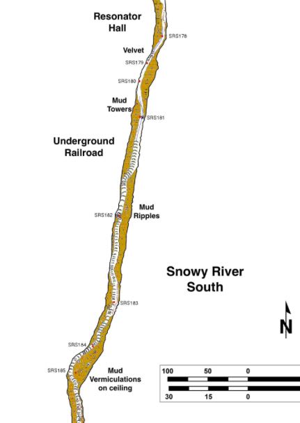
1 |
Underground Railroad
|
SRS181 Ron (This would require a cross section and slope measurement) |
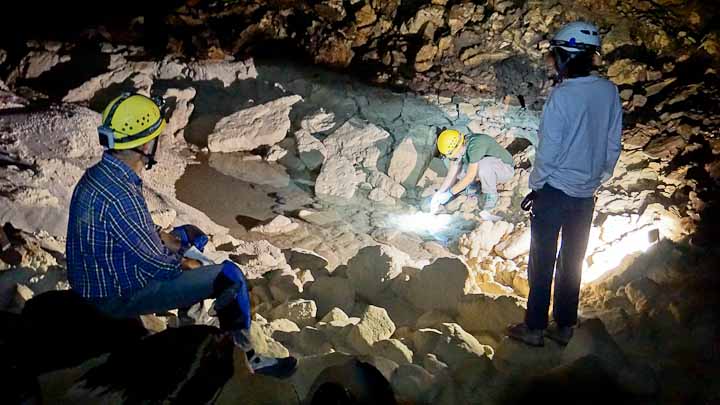
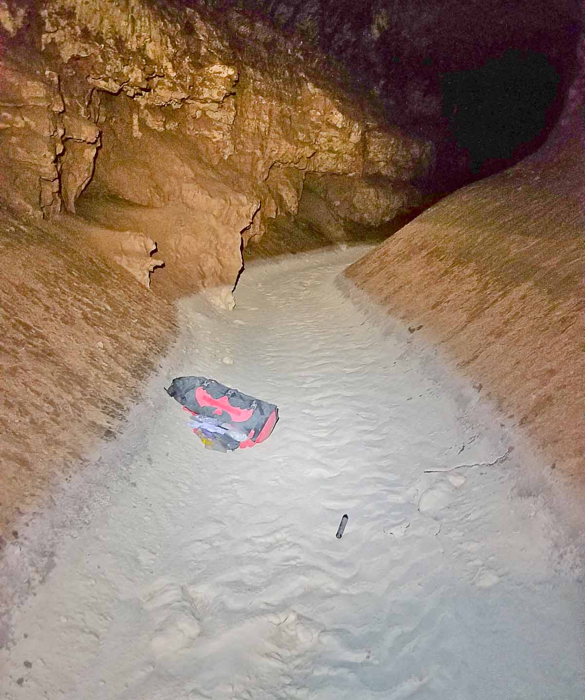
Consider moving the Bobbitt's Blvd. logger upstream to SRS181. Alternately, add a new logger at SRS181 for one flow cycle prior to the current SRS171 location Just upstream from 2-way Hill & Mud Lizard collapse and sump area (Photo: 5-2-09), also good for Manning analysis and would provide additional information on timing of sump flows. We may need a new logger here, but we could move the SRS171 logger upstream 10 stations from Bobbit's Blvd. Would both provide good information on future sumping at Mud Lizard for one flow cycle? |
 |
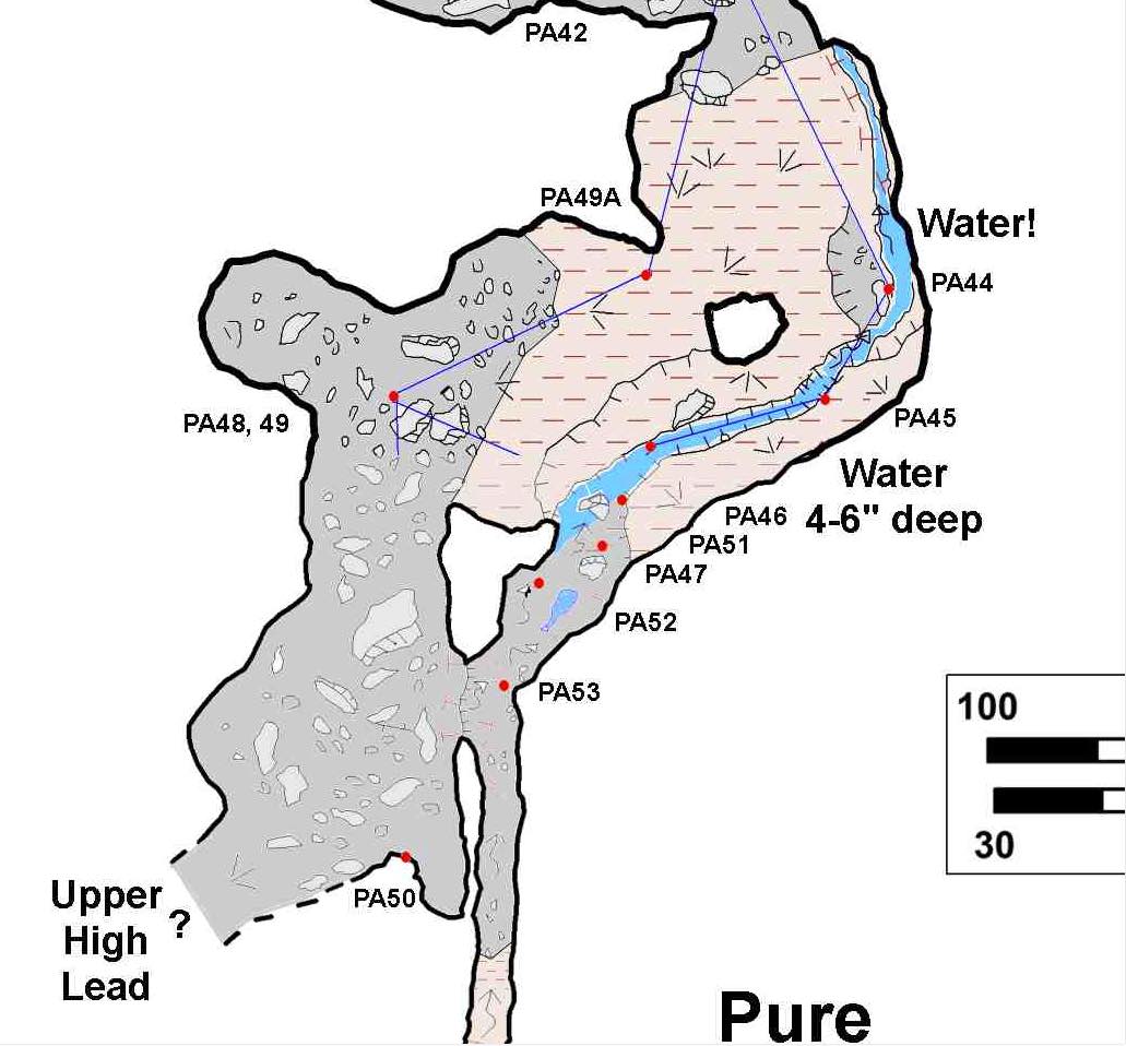
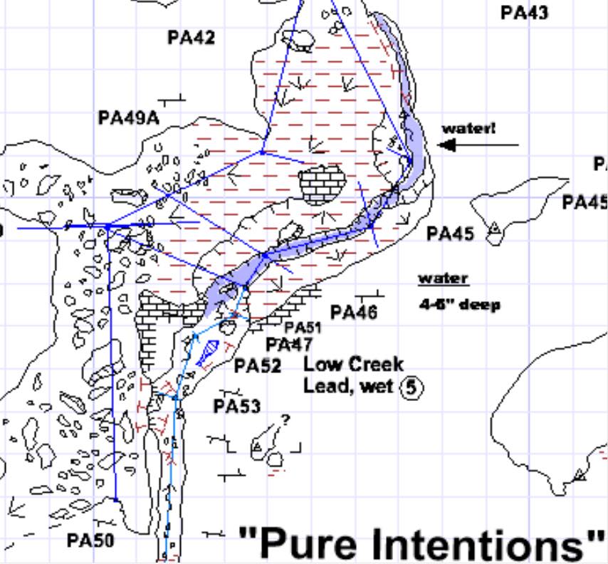
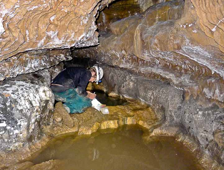
2 |
PA44-PA47 Lee & John L. |
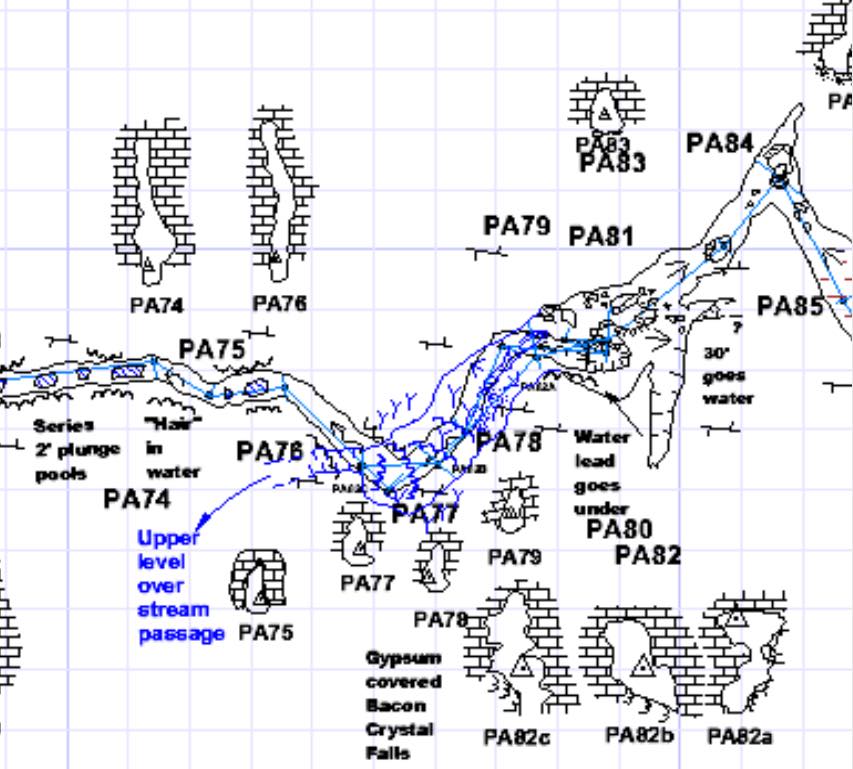
Pool where previous samples extracted 7-4-14 (water & pool fingers). There has always been water seen flowing through Pure Intentions even when Snowy River is dry, yet the water has never been observed reaching Snowy River. We need to understand this better. - Lee "That water disappears in the region of PA50. I'd like to know what's upstream, where it trickles in near PA80 region."
|
|
|
3 |
2-Way Hill & SR Spring |
SRS125 Pete - still under discussion. |
We needed to add another Baro logger to give us improved baro data in the case where Mud Turtle is a sump. A new Baro logger (and also water logger) was installed at the SRS107 Black Rock Bypass connection in 2020, and may be moved to SRS125 at a later time. | It was initially discussed that the logger could be located between the baro & water loggers at Floating Islands and our primary site at Turtle Junction, to allow improved data across the sump when Snowy River is flowing for long durations. But then BRB was discovered and now (2023) we probably want to keep the SRS125 site. |
4 |
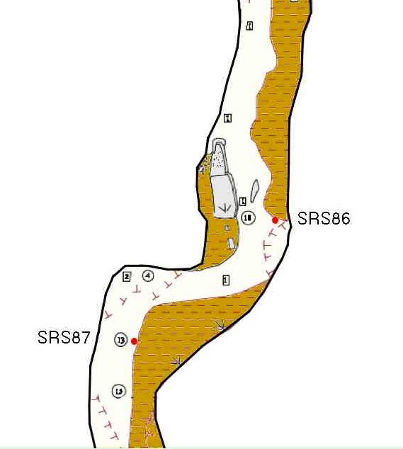 |
SRS87 Ron |
Talon Newton's cross section beyond Independence Hall | Would it be practical to move the BLM Solinst logger from SRS53 upstream to this location? Apparently the BLM Solinst loggers have been removed from this location. Looking for additional comments on any advantages of a logger at SRS87. |
5 |
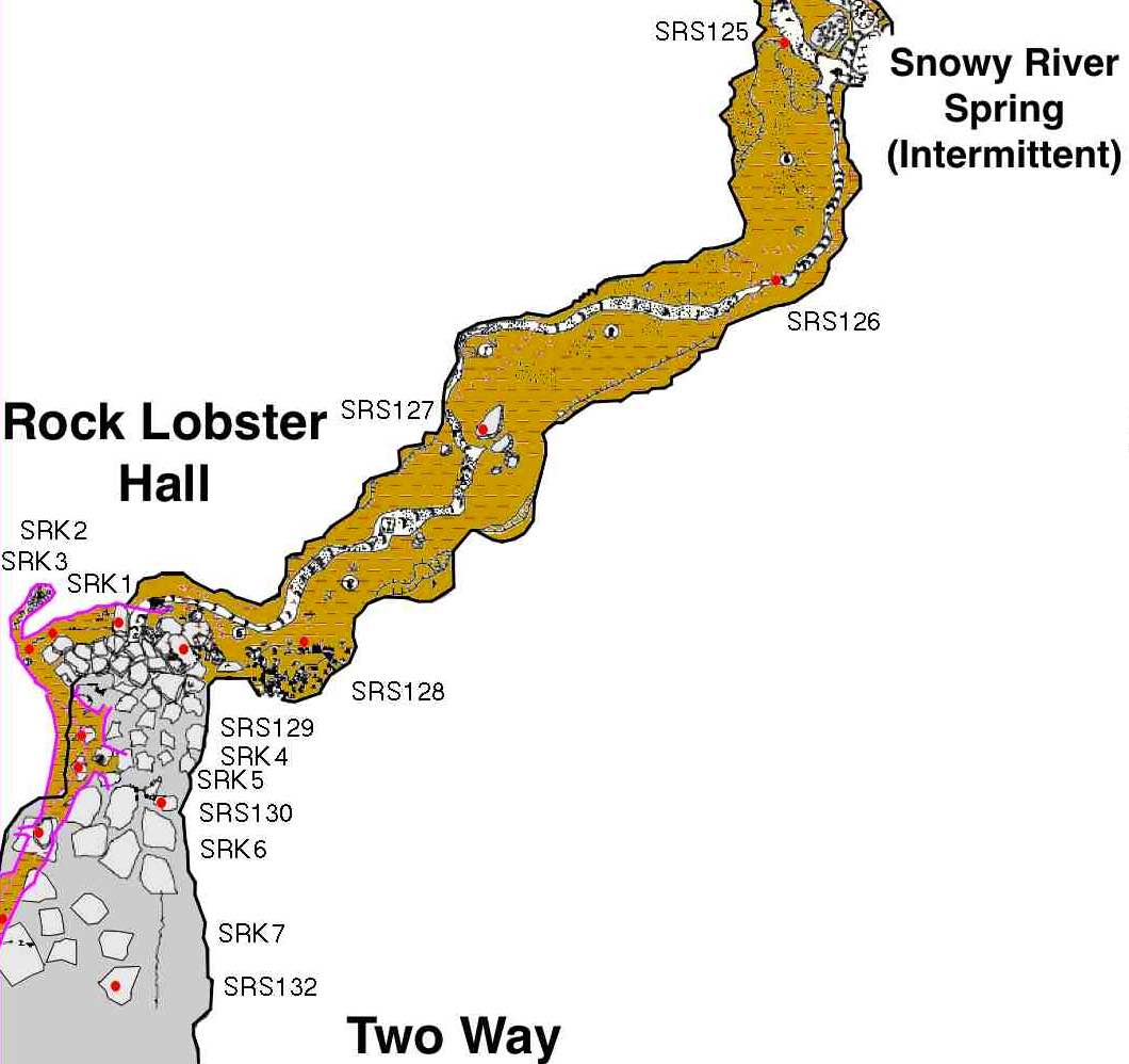
Rock Lobster Hall / Sandy River Downstream |
SRS128? John Lyles, Garrett J. |
Although we have a logger at Snowy River Spring (SRS125), SR flows since 2014 may have also flowed through the Sandy River Sand Boil. The addition of skillfully placed "floaters" may reveal more evidence of this suspected flow. The previously planned new Baro Logger at this location to improve the accuracy of measurements at Snowy River Spring, Mud Lizard, and Bobbitt's Blvd. is probably a moot point as currently there is a Baro unit at SRS107. |
 |
6 |
Snowflake Floor |
Pete |
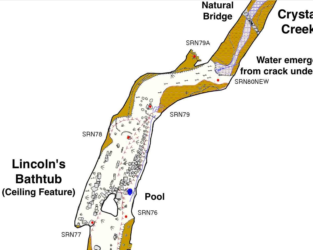
The water logger at the Z9 station was placed to confirm correlation with the Sewer Pipe Landing logger at SW-1. But since installation, the water in the Main Corridor has only gone down, even though Snowy River has seen several flows. A second logger further down Snowflake may show SR correlation and/or possible correlation with the small flow from under the Lincoln's Bathtub breakdown. This crack on the NE wall (towards Snowy River) with a large calcite raft "sucked in" is one site possibility. | 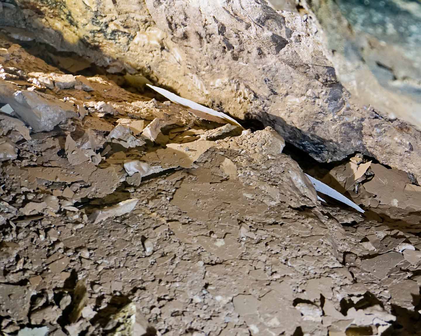 |
7 |
SRS754 |
Pete |
Near SRS754, this large chamber along the Snowy River passage appears to have a large elevated sediment bank. This location is also a possibility for a future cave radio location near the NCA boundary. It may make sense to place a logger here to record the SR flows at this most southern site, while at the same time teams are continuing explorations beyond this point. | 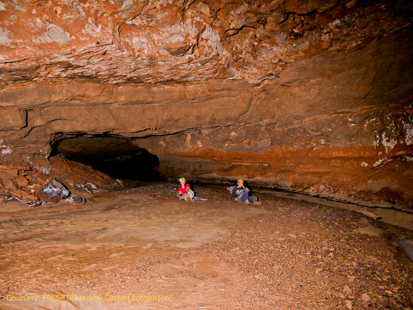 |
Previously Proposed Sites Now Implemented |
||||
Site Name \ Station |
Sponsor / Results |
Comments |
Photos / Additional Information |
|
Crystal Creek Falls (The floor of Lincoln's Bathtub, just above the logger in Crystal Lake/Crystal Spring)
W1 installed 10-12-19 |
Ron Lipinski Completed photogrammetry of cross section near recoverable station EL-1, and is also the location of a previous cave radio beacon. |
This location is just upstream from the 3-foot fall, and will measure flow from under the Lincoln Bathtub breakdown into Crystal Lake. |
 |
|
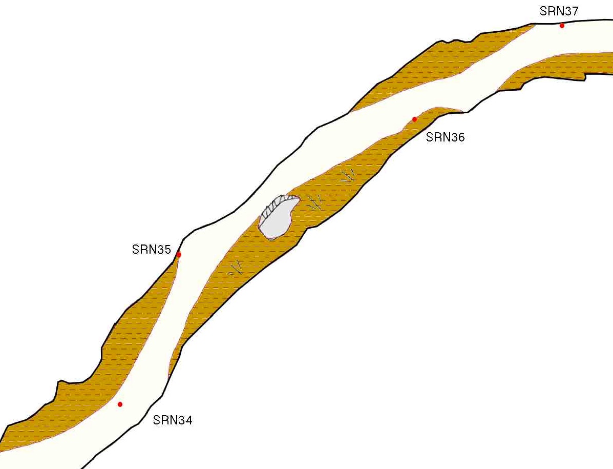
Snowy River North - midway A logger was placed at SRN33 in 2019 |
SRN35
Ron |
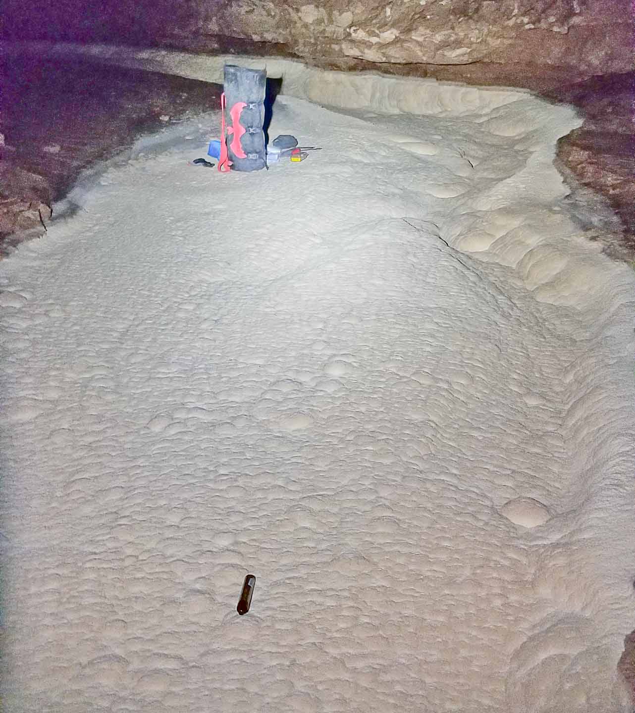
Just north of Metro and Sewer Pipe end or passage to see if sub-rubble flow goes from these passages into Snowy River or into Crystal Creek Spring. The photo above shows a curious "sinkhole" on the West bank of Snowy River at SRN29. |
Water samples have been collected from this pool at SRN39, which seems to hold water longer than the Hot Tub at SRN53 (where there is a logger). |
|
| Window Passage, just downstream from Priority 7 Landing | SRN08
Ron |
Closest location to TJ that provides a lengthy uniform cross section for Manning analysis | W25 logger installed 10-12-19 W18 Logger installed 7-12-18 |
|
| SR upstream from Priority 7 Landing | SRS10
Ron |
Closest location to TJ that provides a lengthy uniform cross section for Manning analysis | W23 logger installed 10-12-19 W11 Logger installed 7-12-18 |
|
| Plunge Pool + Turtle Junction | SRS23 & SRS31
Pete |
Event programming test: Add two water loggers set to record at 2 minute intervals when the water level is changing. Improved data on rate of Plunge Pool filling, and then the same rise at Turtle Junction | Normal sample time15 min, fast sample 2 min. W2 & W5 installed 10-12-19. 1-year data shows better programming for event-level programming. | |
Mt. Airy SRS227
(From Station SRS227 the logger is located 23.9 ft., @ 279.6 Deg Az, and -12.1 Deg Inclination) |
SRS227
Garrett |
This site was suggested as a future discharge measurement location. W33 was placed here on 10-14-19 |
 |
|
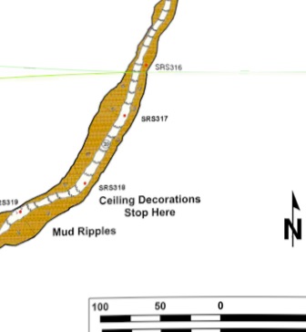
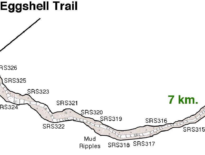
Eggshell Trail (From Station SRS318 the logger is located 36.4 ft., @ 19.1 Deg Az, and -3.3 Deg Inclination) W34 was placed on 10-14-19
|
SRS318
Garrett |
Just upstream of Mt. Airy This site was suggested as a future discharge measurement location.
|
 |
|
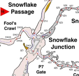
Snowflake
Snowflake Passage near Fool's Crawl exit |
Z9
Pete |
A water logger placed here could better define the hydrology between a flooded Conrad's Branch and a flowing Snowy River. Currently we believe the relative elevations are almost the same after multiple Palmer Pole surveys between DD-1 and TJ Brass caps. The information gained would be timing relationships between water arrival at the three locations, and if there is a water input from the Snowflake side of Fool's Crawl. Observation of the water temperature timing between the three sites may provide new clues to the drainage path of Conrad's Branch. W? logger installed 10-16-19 |
 |
|
1 |
Downstream from SRN53 |
SRN74 by Ron, Pete, Talon and Scott |
Placement of a logger at a future discharge site NE of th Swimming Pool may provide information on drain-down in an area of decreasing Snowy River calcite thickness, suggesting a thinner layer of under-calcite sediments. |
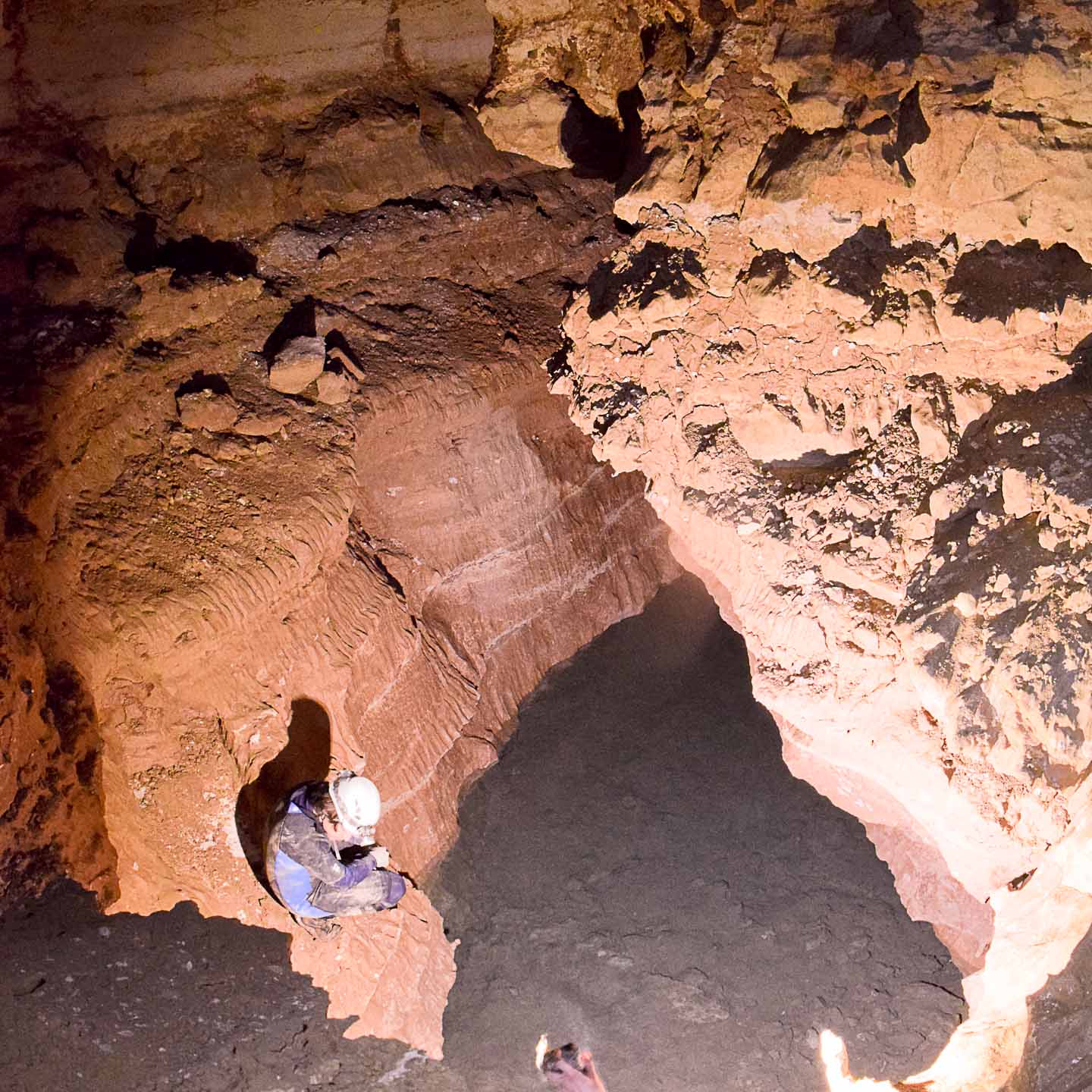
In May, 2021, the Snowy River North logger maintenance trip included two hydrologists, Talon Newton and Scott Christenson who were tasked with finding the best location for a discharge site where both a baro and a water logger were installed. A second trip on May 19, 2022, performed the photogrammetry and slope measurement task required for a discharge site. |
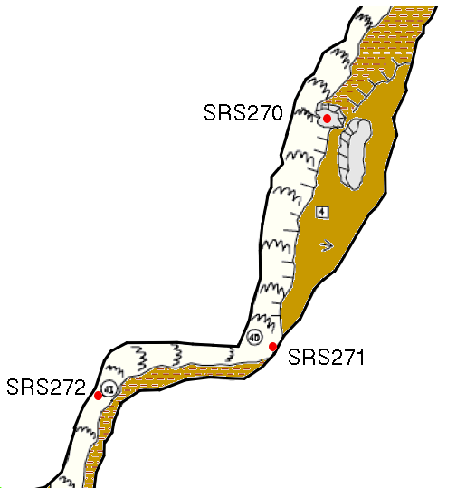
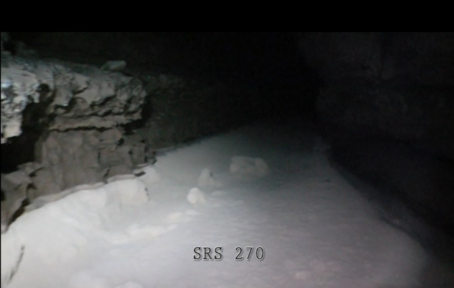
3 |
Near Mt Airy
|
SRS270
Ron |
Proposed just downstream of Mt. Airy, compare with SRS318 (Unknown Photo) The location chosen by Garrett was at SRS227 (Mt. Airy) and also at SRS318 (Eggshell Trail) and both were added 10-14-19. Since that time at least two flows should have been recorded and we await the next possibility to recover these loggers. |
 |
Rev. 2-27-2023 |
Comments to the webmaster |
Contact the FSCSP President |
Contact the Project Director |