USGS 08387600 Upper Eagle Creek:
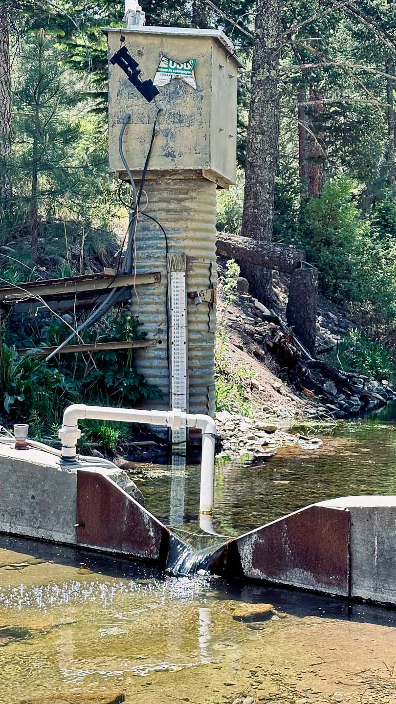
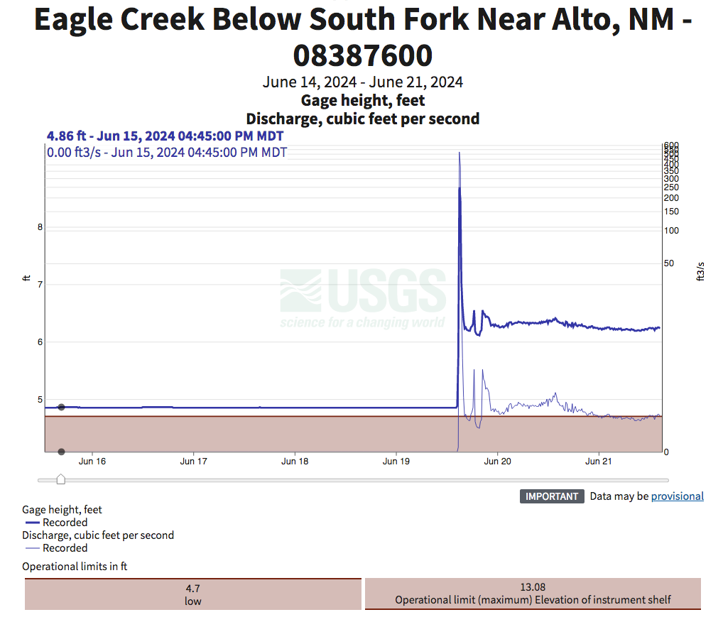
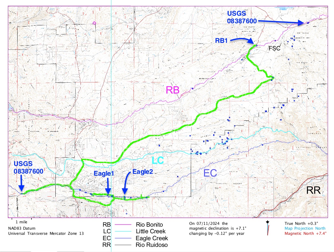
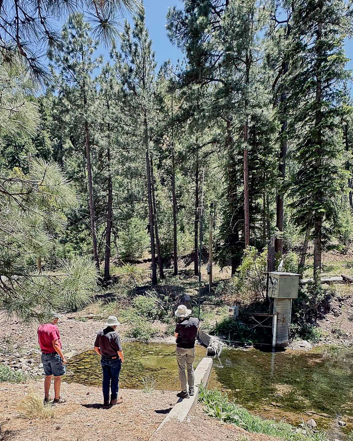
This USGS site (click on the link to the above-left) has been used by the FSCSP for the past decade to predict future possibly Snowy River flow events. It is periodically re-calibrated after significant flow events to account for the Eagle Creek cross section changes and other factors. This is the highest elevation Eagle Creek site data to be streamed to the cloud. Additional details on other USGS water monitoring sites are HERE.
|
|
|
 |
Alto Lake & downstream to Eagle1 site:
This area below the lake modifies the measured flows from the USGS Upper Eagle Creek station. There is evidence of two new wells adjacent to a large geologic feature called a dike (where the limestone beds are almost turned on end), and we suspect this might connect Eagle Creek to underground aquifers that may feed Snowy River.
|
|
|
 |
Eagle 1 Site (Surface Data Logger)
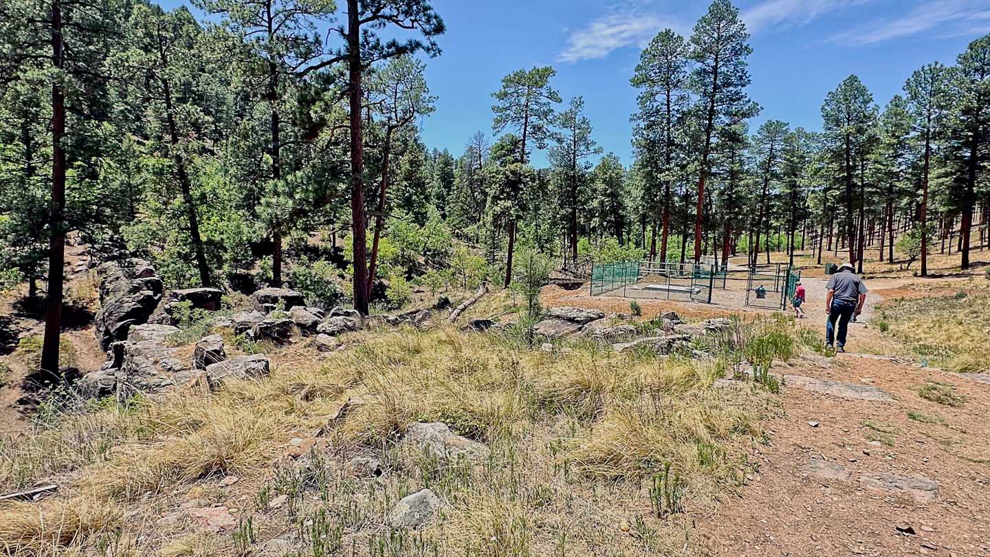
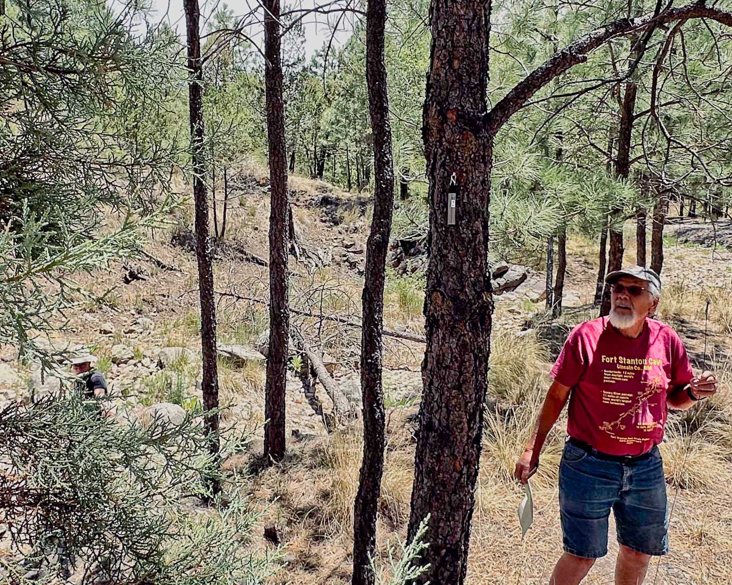
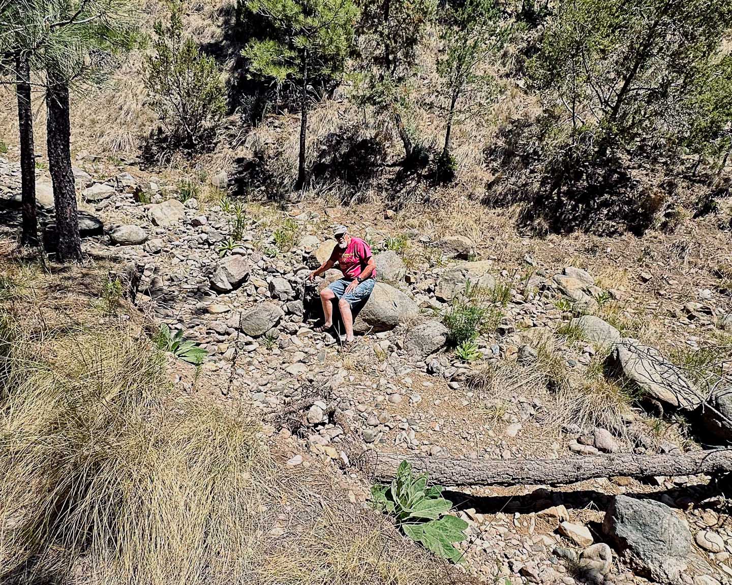
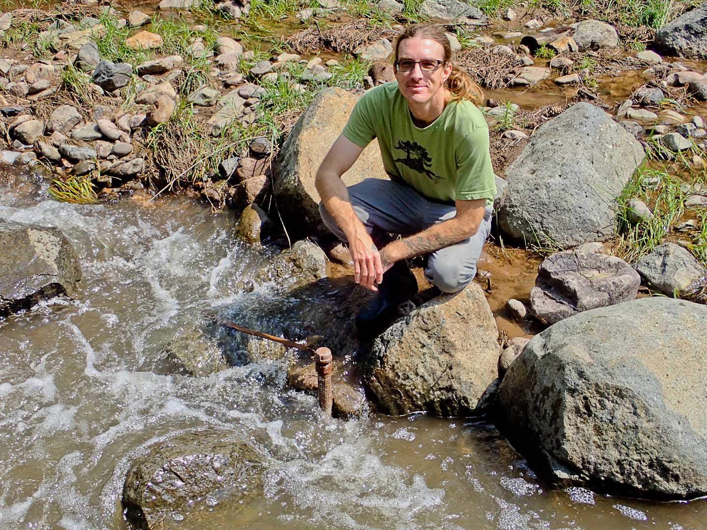
This site is on private property and was first noticed by the owner as interrupting the initial spring or summer monsoon flow of Eagle Creek. The FSCSP installed a water / temperature data logger at this second dike site to gain additional surface flow information. Steve Peerman points out the location in a boulder-filled creek bed that occasionally sees large trees being washed downstream during a flood event.
|
|
|
 |
Eagle 2 Site (Surface Data Logger)
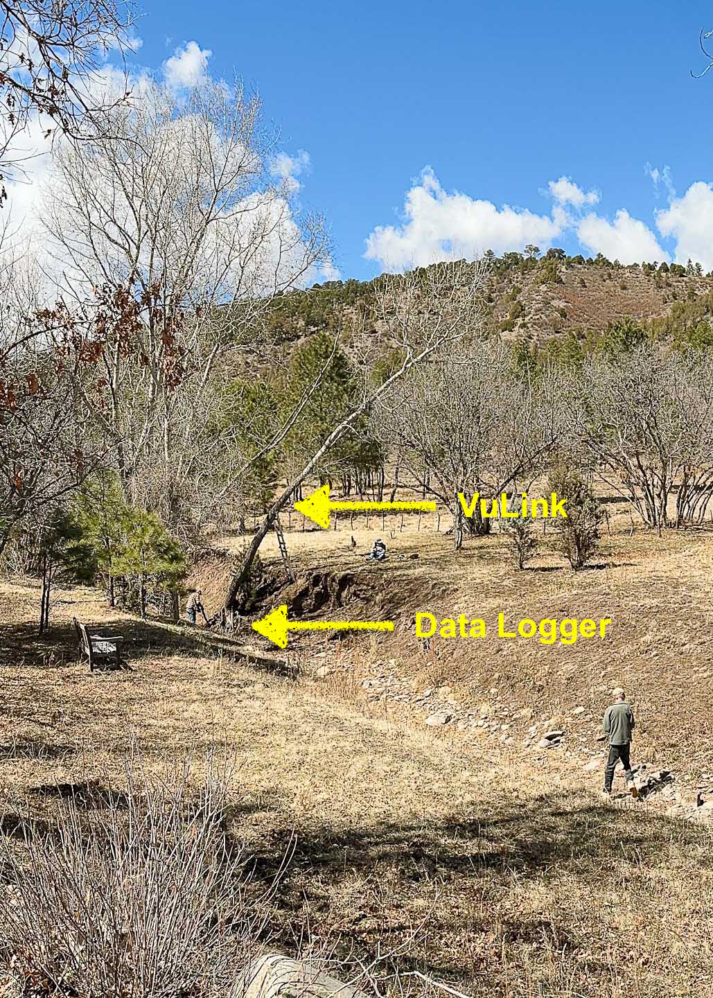
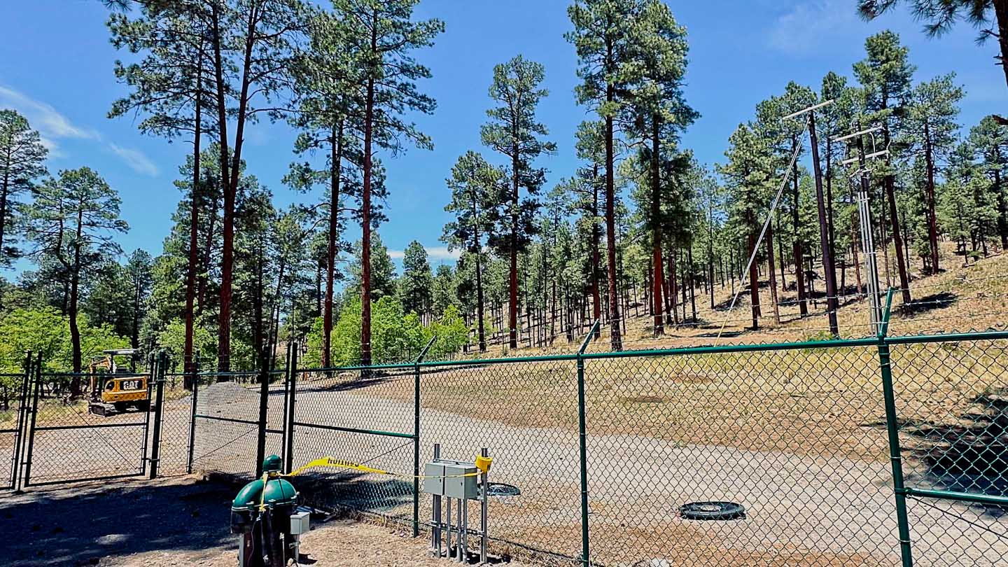
Our initial Study Project goal was to provide information on the Government Spring resurgence of Snowy River by implementing specialized hardware developed by our data logging provider In-Situ. The new hardware is called a Vu-Link and essentially is a cloud-based surface internet connection to an RT-200 data logger that measures the depth and temperature of a surface water source. It became obvious that this surface site near the suspected insurgence area would provide more timely Snowy River flow information that would assist the timing of deep Snowy River teams working in the cave. Initial installation was in 2023.
Note: Due to the severe 2024 fires in the Ruidoso area, including the destructive South Fork Fire, we discovered that at least four cell phone communication towers were off, and our connection to the Eagle2 site was down. Fortunately the system recovered quickly and no data was lost.
|
|
 |
Turtle Junction (Cave Site)
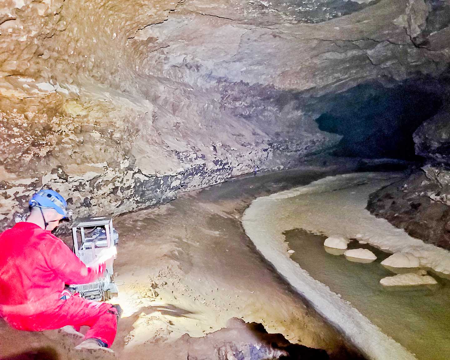
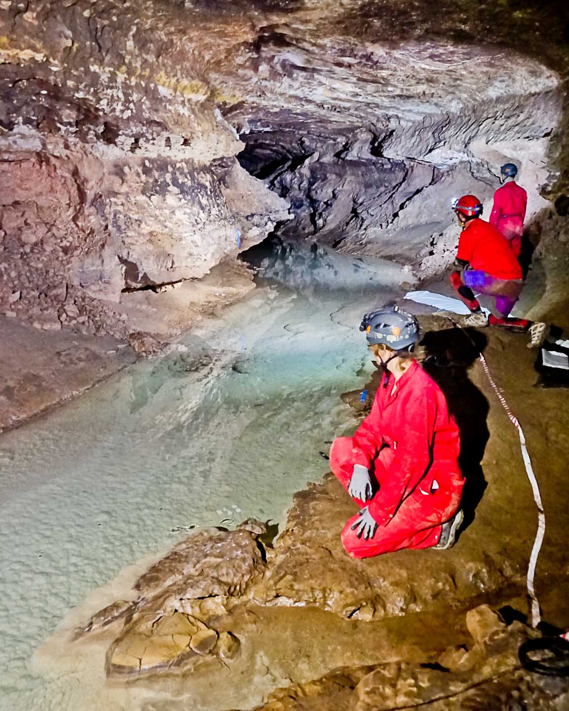
This primary Snowy River cave site, about 1 mile from the entrance, is one of over 20 data logger sites where the cave streams are monitored. We believe that this water comes from a section of Eagle Creek that appears to loose 10-20% of its flow during normal intermittent flows. In the past, these flows have been correlated with the upper Eagle Creek USGS station, and this is the only location in the cave where we have access during a Snowy River flow. The flow rate at Turtle Junction is just above 1 cubic foot per second (cfs) as measured using a Pygmy flow meter. The route to this location is through the cave entrance into the Main Corridor, and then through Conrad's Branch to a large room (DSMH) and then down a hand-dug 44-foot deep access shaft followed by a partially crawling low passage called Mud Turtle. During very wet seasons when Snowy River is flowing, the Conrad's Branch section fills with water (probably from the Rio Bonito stream near the entrance) up to 7-feet deep, requiring flotation and wet suits for the cavers. In the 1800s soldiers from the Fort actually built a boat that was assembled just below "Inscription Rock" where many recorded their visits. Currently we have an ultrasonic water sensor that sends "flow or no-flow" information to the cloud through a BLM-funded custom designed Buecher Net radio system that also includes an innovative Longwire section that carries the signal through the smaller Mud Turtle Passage.
|
|
 |
Rio Bonito Surface Logger Site (RB1):
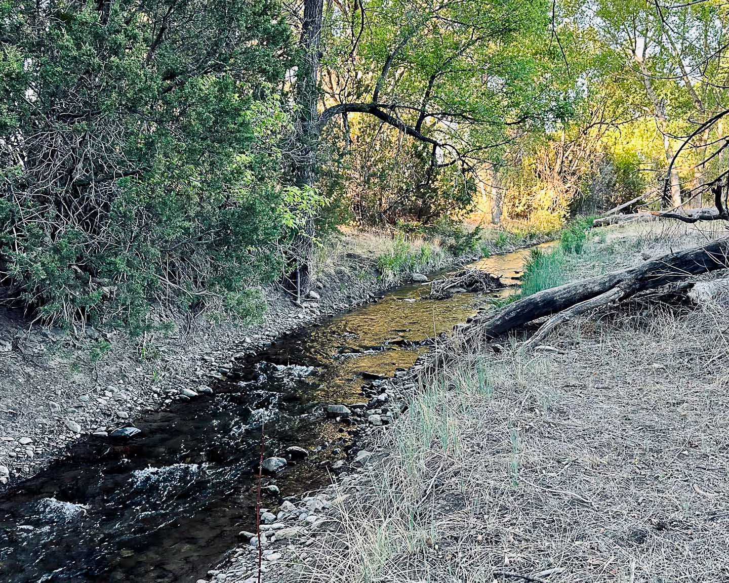
Just upstream from a surface data logger mounted on a tree is a straight section of the Rio Bonito where we have used a Pygmy flow meter to provide calibration via cross sections recorded by using photogrammetry techniques.
Several decades ago, downstream from RB1 towards the Government Spring site, a dye test in the Rio Bonito stream actually proved that the Rio Bonito "leaks" into the Main Corridor of Fort Stanton Cave during some conditions. Currently the FSCSP is monitoring the Main Corridor water level in a pipe driven 20 feet into the clay floor, and it is believed that this surface water source may be related to the occasional flooding of the Main Corridor of Fort Stanton Cave.
|
|
 |
USGS 08389055 Rio Bonito and Government Spring:
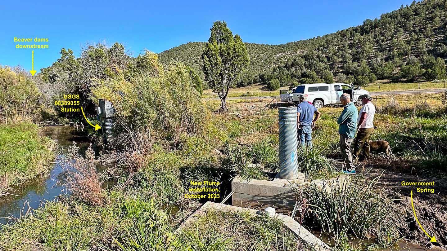
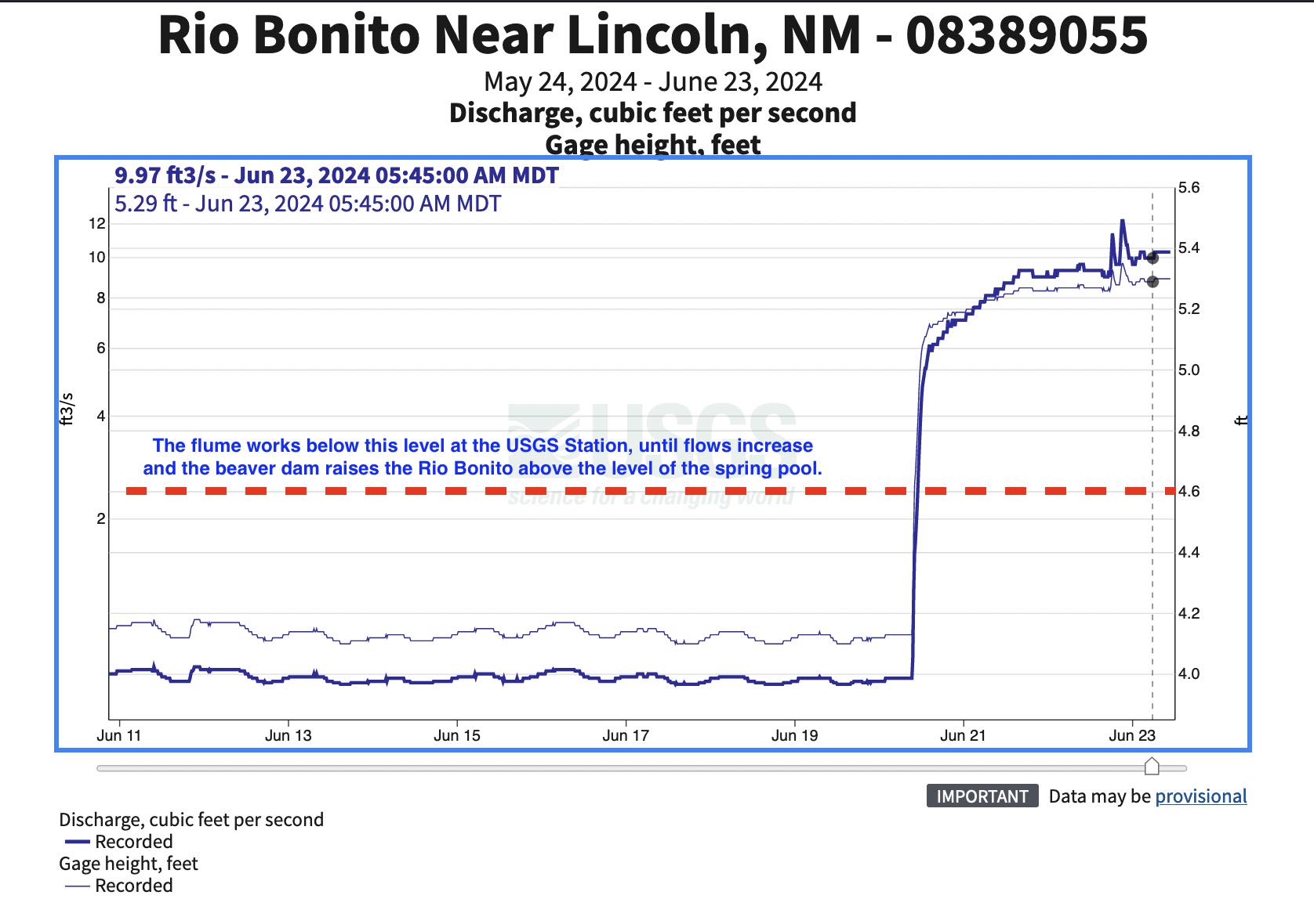
This USGS site is currently back in operation after many years of non-use. This is the cave exit (or resurgence) of the underground Snowy River that has been explored for over 14 miles heading towards the Eagle Creek USGS station. This site was known in the mid 1800s by the soldiers at Fort Stanton who explored the first two or three miles of the cave. It was likely known as a water source long before that time by Native Americans. |
|
 |
Sample Data from Specific Surface Sites and Fort Stanton Cave
|
|
This 139-page March 2021 FSCSP report covers the majority of past data logging in Fort Stanton Cave and Snowy River. As one of longest stream passages in the world monitored by data loggers with only a single cave entrance, you can follow our team's efforts as we extend our knowledge of the local Hydrogeology. But as we answer a few of the past questions, we are also identifying new questions. Please check back for the latest information. |
 |
|
|
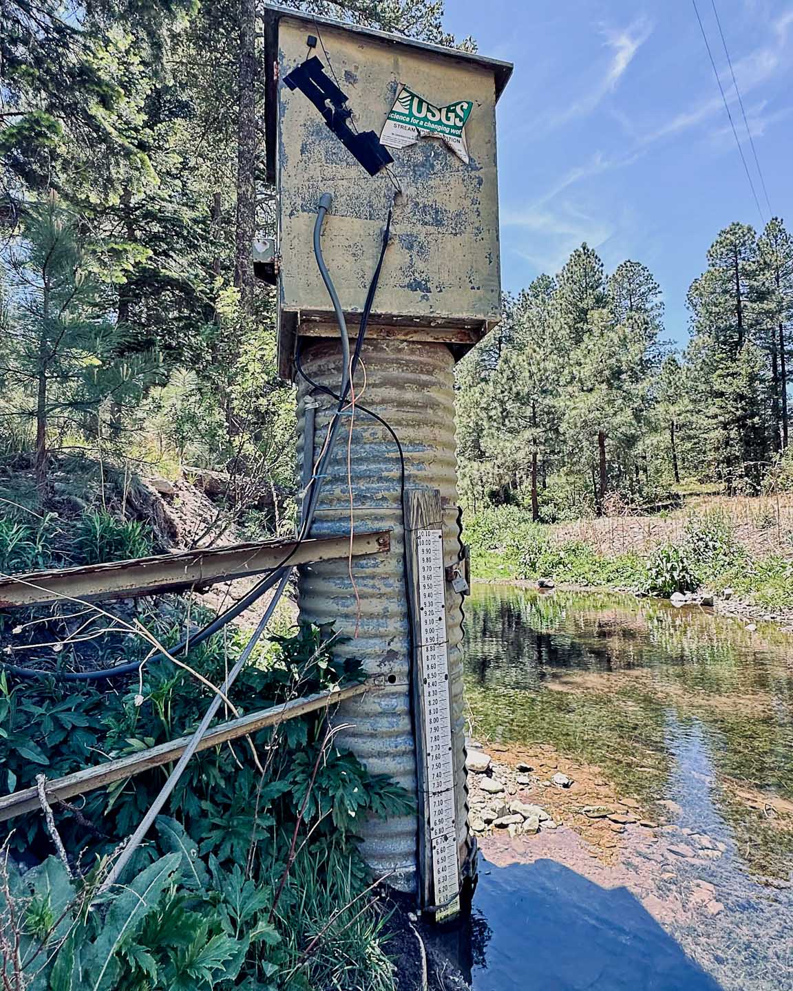
Looking upstream at the USGS Eagle Creek station, a small dam with a custom "V-Notch" is used for calibration for actual flow measurements. The water pressure sensor is located inside the galvanized pipe structure so that only a small pressure tube is required to be located at the base level of the water. A top-mounted antenna allows connection via satellite to the cloud which is usually very reliable and well-protected against flash floods and forest fires. Occasional large water flows may require a calibration update for "normal" 1-3 foot deep flows. |
|
 Compensated w%3AB5 Baro @ TJ (297).jpg) |
|
Rio Bonito 1 |
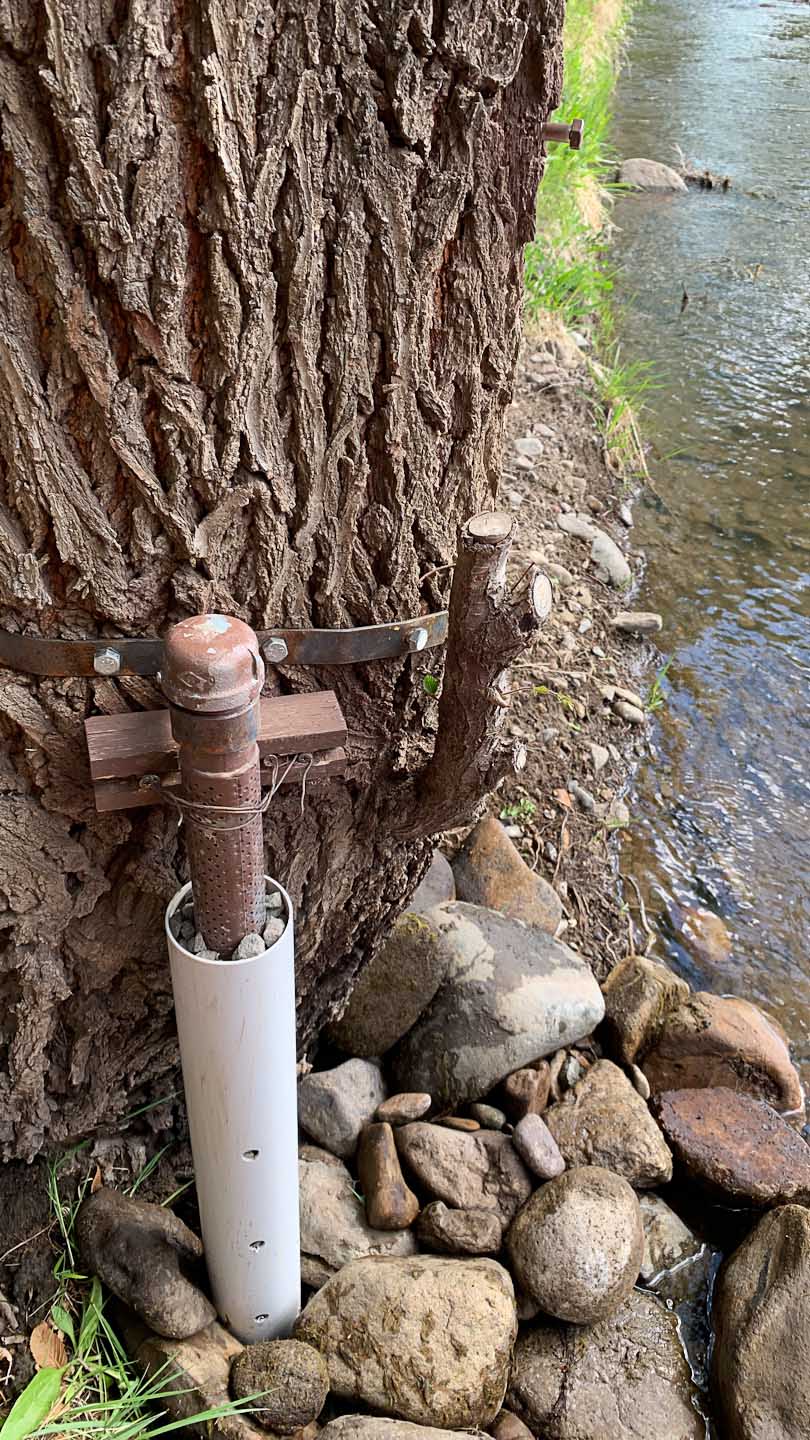
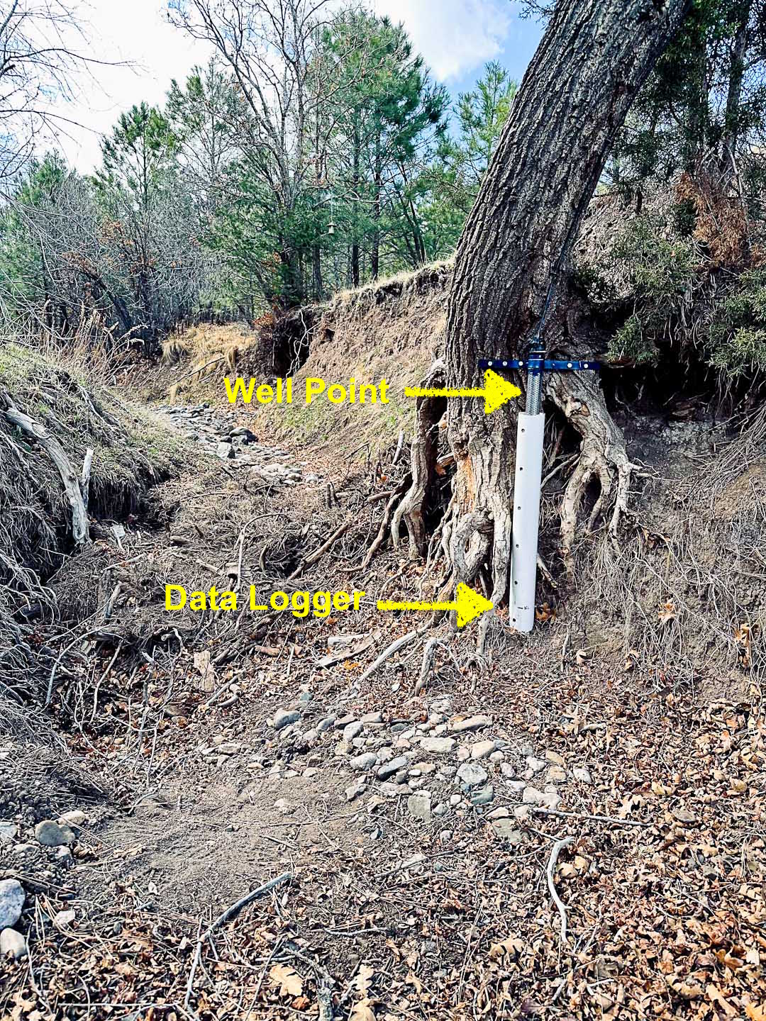
Looking upstream at the Rio Bonito 1 data logging station, this photo shows the typical FSCSP method to protect the data loggers from unexpected flash floods that have previously washed away "normal" staff gauges located in the stream. By installing the data logging sensors on the "downstream side" of a large tree, next to the stream, we have successfully prevented the loss of the sensors at the same time have recorded both the surface water temperature and water depth. The data loggers are installed in a well point, which is a 1-meter long perforated steel pipe in which the water sensor is installed at or just below the expected low-water elevation. A 2nd PVC pipe with a small number of holes is around the well point, and small gravel between the two pipes helps to center the pipes. A steel strap is secured with several bolts to adjacent structure, and a custom wire retrieval device is used to extract the sensor after removal of the pipe cap.
|
|
 (5-11-19 to 10-2-20) (786).jpg) |
|
|
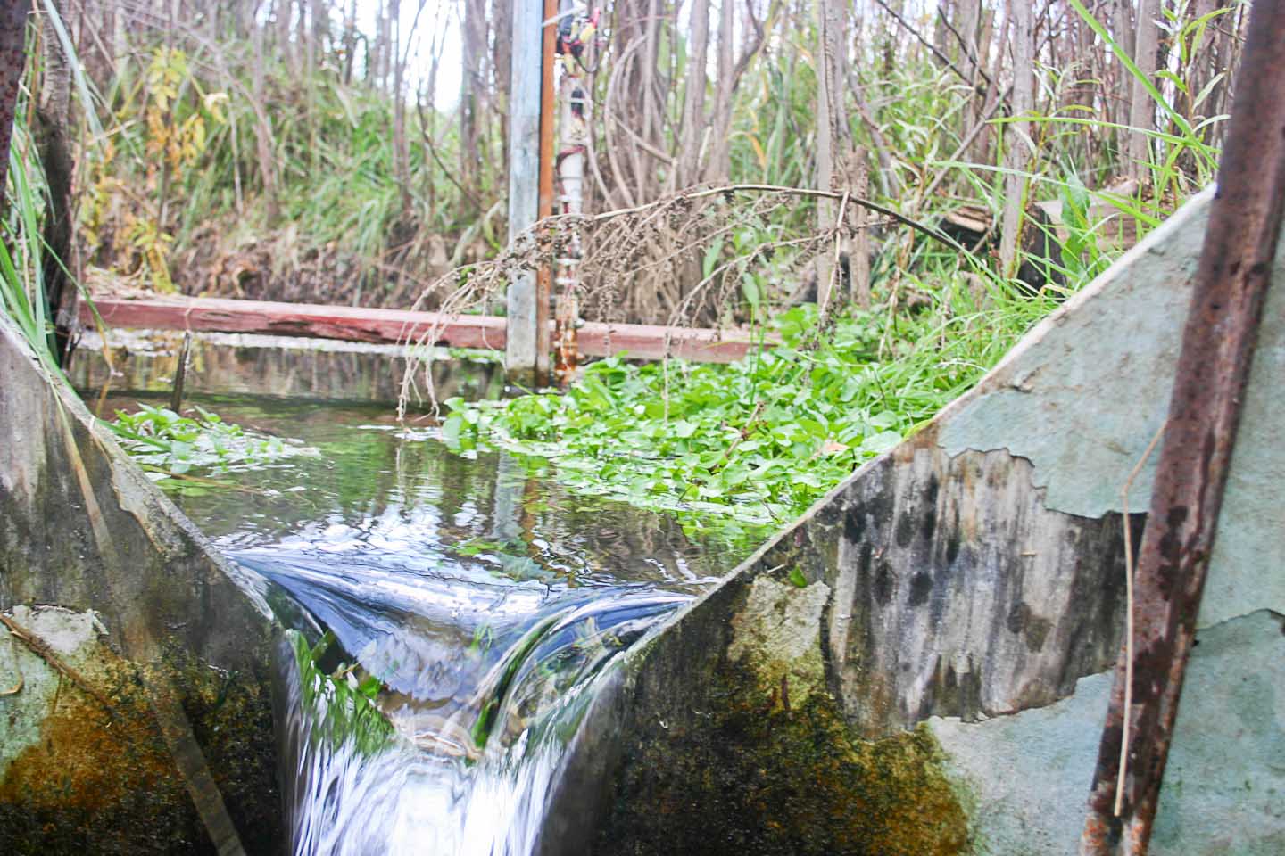
In 2010, several years after the discovery of the Snowy River Passage, we realized that we needed to monitor both Government Spring and Turtle Junction in the cave. This photo shows the FSCSP plywood weir in place with Snowy River flowing. Four years later following the Little Bear Fire, a flood washed away this structure.
|
|
 |
|
|
This October 30, 2010 photo shows the older USGS station, installed on the Rio Bonito just downstream from the spring, that was using a simple concrete V-notch dam for calibration with 1-foot normal flows. The 4.6-foot staff gauge at this location is now obsolete because of a 4 or 5-foot high beaver dam across the Rio Bonito.
|
|
 Zero flow adjusted (5-9-19 to 10-3-20) (487) 2.jpg) |
|
Eagle1 |
This Eagle1 site was chosen after the private property owner reported that initial flows below his house located above Eagle Creek seemed to stop flowing and sink into the ground for the first several days. A geologic feature called a dike was at this location and was an obvious contributor to water possibly leaking into the underground aquifer that feeds Snowy River. Only the steel drill point was used and was bolted to an upstream boulder for protection. |
|
Help on Eagle2 HydroVu Graphing (in-work) |
|
Eagle2
|
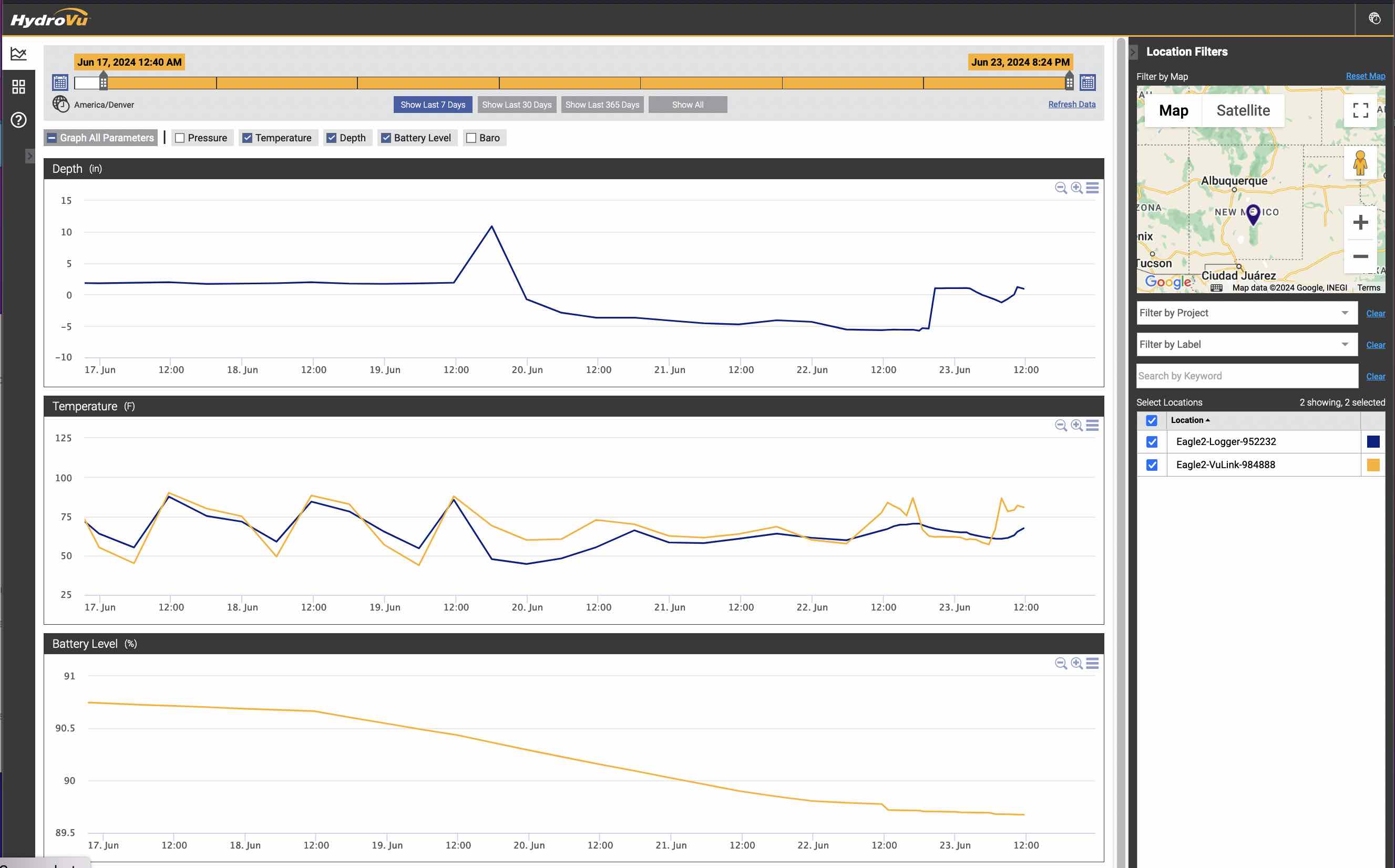
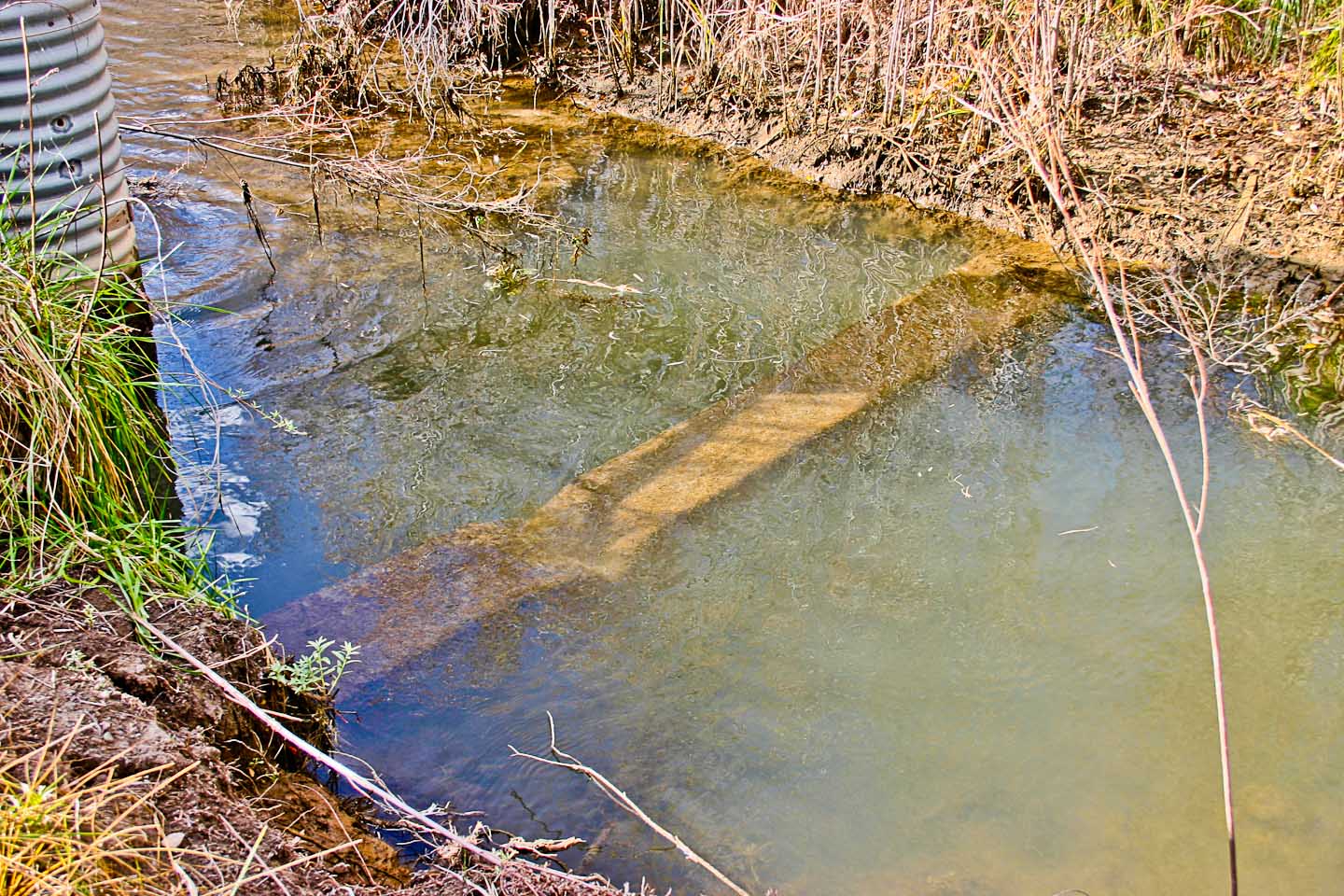
The Eagle2 site, downstream from Eagle1, was even more challenging. A large tree on this private property had formed a dam with the logs washed downstream, and there was a foot-deep hole, just below the dam, washed into the gravel stream bottom. The timber forming the dam was removed and the roots of the large tree were used to secure our standard well point installation which placed the water sensor at the approximate level of the straight stream channel just downstream. We plan to use a Pygmy flow meter in combination with the logged water depth and an accurate stream section cross-section recorded using photogrammetry techniques to compute a calibration curve for this installation. |
|
 (5-19-22 to 4-14-24) (890) 2.jpg) |
|
Turtle Junction |
The Turtle Junction site is the most important site in the cave because we have access to this site, about a mile from the entrance, for 4-5 months during the year, even if Snowy River is flowing. Other instruments are set up at this site including a real-time ultrasonic water detection sensor and an evaporimeter data logger. |
|
 | Home Page | About Us | Contact Us | Participation | Privacy Policy | ©2024 Ft. Stanton Cave Study Project





 Compensated w%3AB5 Baro @ TJ (297).jpg)
 (5-11-19 to 10-2-20) (786).jpg)

 Zero flow adjusted (5-9-19 to 10-3-20) (487) 2.jpg)


 (5-19-22 to 4-14-24) (890) 2.jpg)
